
Fort William is not the most prepossessing town, and our memories of it are somewhat tainted by the fact we almost always visit in poor weather when the grey wet days match the grey stone and concrete and everything just feels drab.
It’s certainly a town that’s made better by the sunshine hilighting the magnificent scenery, with the bulk of Ben Nevis and the waters of Loch Linnhe taking attention away from some of the more utilitarian buildings. Last time we stayed here in Bertie we had been on the west side of the town, parked by Neptune’s Staircase and enjoyed an evening of fine weather between two drizzly days. This time we were hoping for slightly better weather as we made our way to Glen Nevis for the final stage of our early summer holiday.
The road from Loch Lomond to Ben Nevis was busy and slow on this Saturday morning. We wished we had planned a weekday change of venue as we squeezed past other motorhomes all enjoying the freedom to travel. Twice we ‘kissed’ wing mirrors with other vans as the game of chicken was played out over narrow sections of road, and my heart was in my mouth each time someone lifted their hand from their steering wheel to wave at us, with the consequent drift of the van towards the centre of the road. As Bertie is left hand drive, my navigator’s seat is in the centre of the road and makes me very aware and nervy of these roads where two lanes are squeezed into such narrow straits. I would much rather be on a single track road with passing places.
While I’m talking about driving, it’s worth mentioning that we avoided Loch Lomond on the way back. Instead we turned off at Crianlarich onto the A85/84 which was a much quieter route and gave us a change of scenery too.
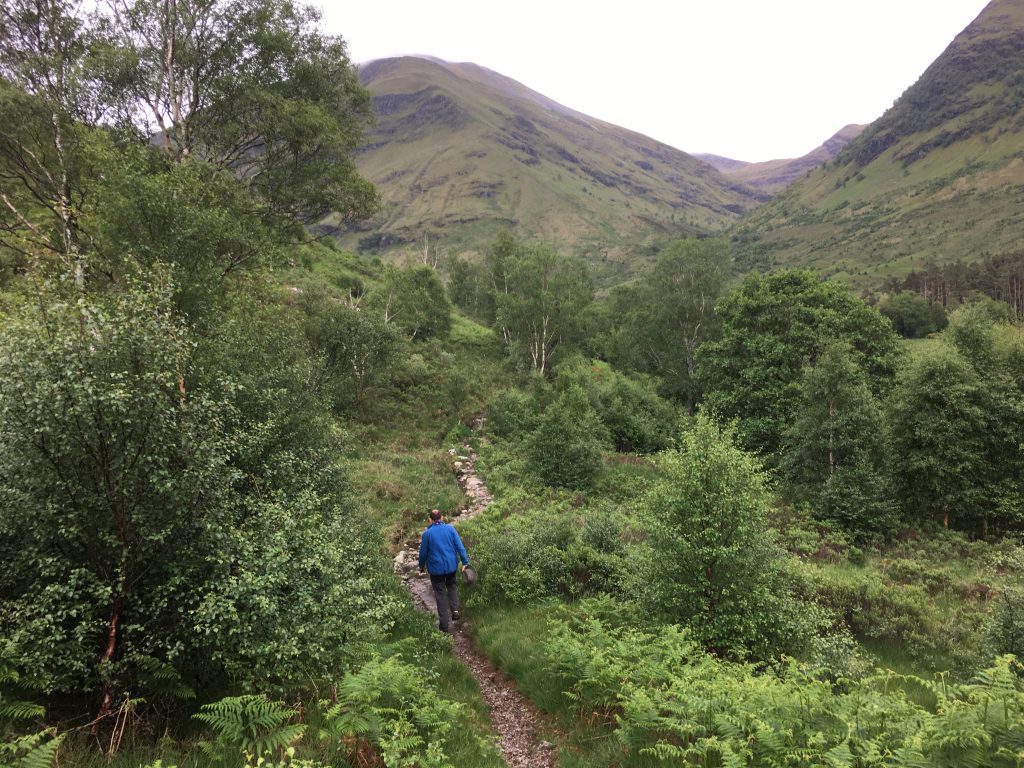
Regardless of the slightly stressful drive, we enjoyed the increasingly mountainous scenery as we headed north. Glencoe always feels like the entrance to the highlands to me, the marvellously atmospheric corridor funnels travellers towards the west. The mountains and the sea await!
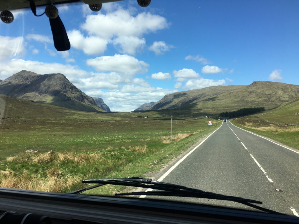
The Road into Glencoe
Our stay for the next seven nights was at Glen Nevis campsite just outside Fort William, on the road that runs along the glen. Once upon a time seven nights would have seemed a long time to spend in one place but in all honesty we could spend months here. It provides access to many walks and bike rides. It’s a huge campsite, with a lot of pitches on hard standing and grass and is frequented by a lot of people toting huge rucksacks, finishing the West Highland Way. It has a shop, good clean facilities and next door is a restaurant/bar which made a convenient stop after our walks and did a mean haggis – I cant get enough of the stuff and think I had it three times in either starter or main form.
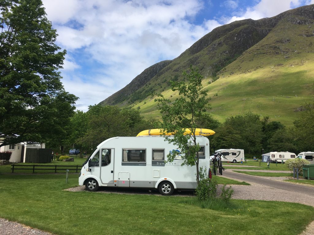
Nestled under the hills in the Glen Nevis campsite.
The weather grew increasingly unsettled while we were here, and yet again we didn’t make it up Ben Nevis (the next time I go up the Ben has to be via the CMD Arete on a glorious day, so I’m saving myself). But we did enjoy walking and mountain biking in the glorious surroundings, watching the mountains and the clouds, spying walkers on the path ascending the first stage of the route up the Ben, and contemplating the reason for the occasional helicopters hovering over the hillside (hopefully on exercise). In the forest we heard the sounds of cuckoos and everywhere was full of the sound of water and rustling trees.
Our journey home from Glen Nevis to Exmouth was a long one. We made it as far as Birmingham before deciding that we’d had enough (well, I could have carried on, but I wasn’t driving). After making a few phone calls we made our final stop at the Camping and Caravanning site in the Clent Hills. Not too far from the motorway it made an ideal stopping off point to allow us to rest up and sort out Bertie to go back into storage for a few weeks.
Here’s a selection of the routes we did while we were here, we’ve still got plenty of things to do next time we come for a visit.
Bike and Stroll to the Steall Falls
From our campsite there were a couple of options for getting to the head of the glen. We could drive and park by the Polldubh falls (the parking further up the valley is too small for our big Bertie and there is a bridge with a weight limit that wont take our 3.85 tonnes), or we could walk or cycle. The Glen Shiel bus company sometimes run buses to Polldubh falls, but they weren’t in operation when we were there.
Although the walk to the Steall falls would have been longish but perfectly pleasant 20k round trip from the campsite, we decided to go for the bike ride to test out how it would work for walks later in the week.
We tried out the cycle along the road, gradually but easily climbing up to the Polldubh falls where we stopped for a quick peek at the pretty falls, then we continued on to the busy parking at the end of the road where there were bike racks at the very far end of the parking area.
Polldubh Lower Falls – seen from below
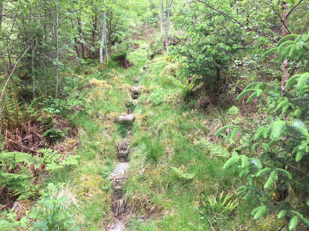
The walk from here took us further along the side of the gorge by the rushing Waters of Nevis until we reached the wide open valley that reminded us of alpine meadows. Here the river takes advantage of the broad flat meadow and meanders along it’s pebble bed, we spent some time paddling in the shallow waters, playing on the infamous rope bridge (slightly unnerving but not as difficult as I expected) and watching the intertwining ribbons of water falling down An Steall.
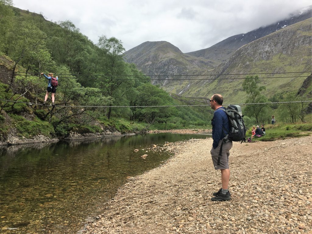
The famous rope bridge
There are loads of longer walks from here, but today we retraced our steps back to the bikes and cycled back to the campsite, taking a slightly different route back by diverting on the forest track just past the Polldubh car park.
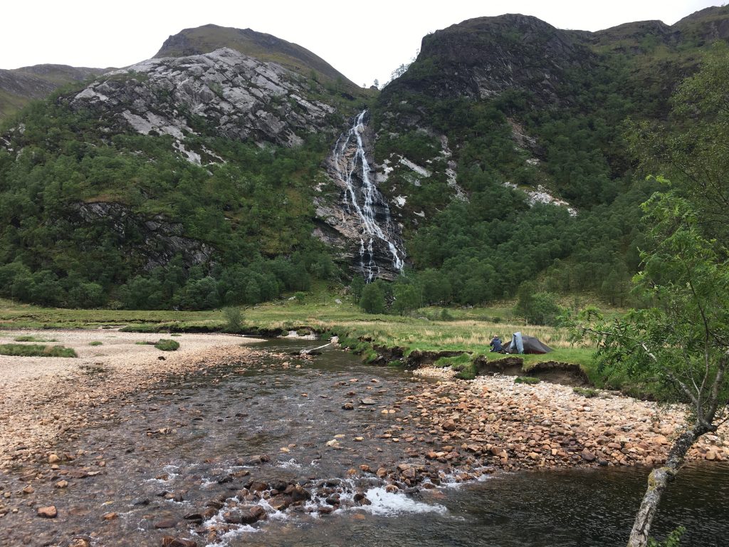
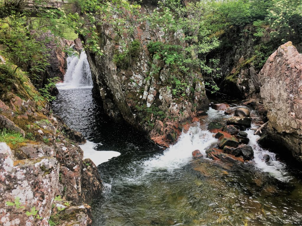
The Steall Falls with slightly low water levels
Stob Ban and Mullach nan Coirean
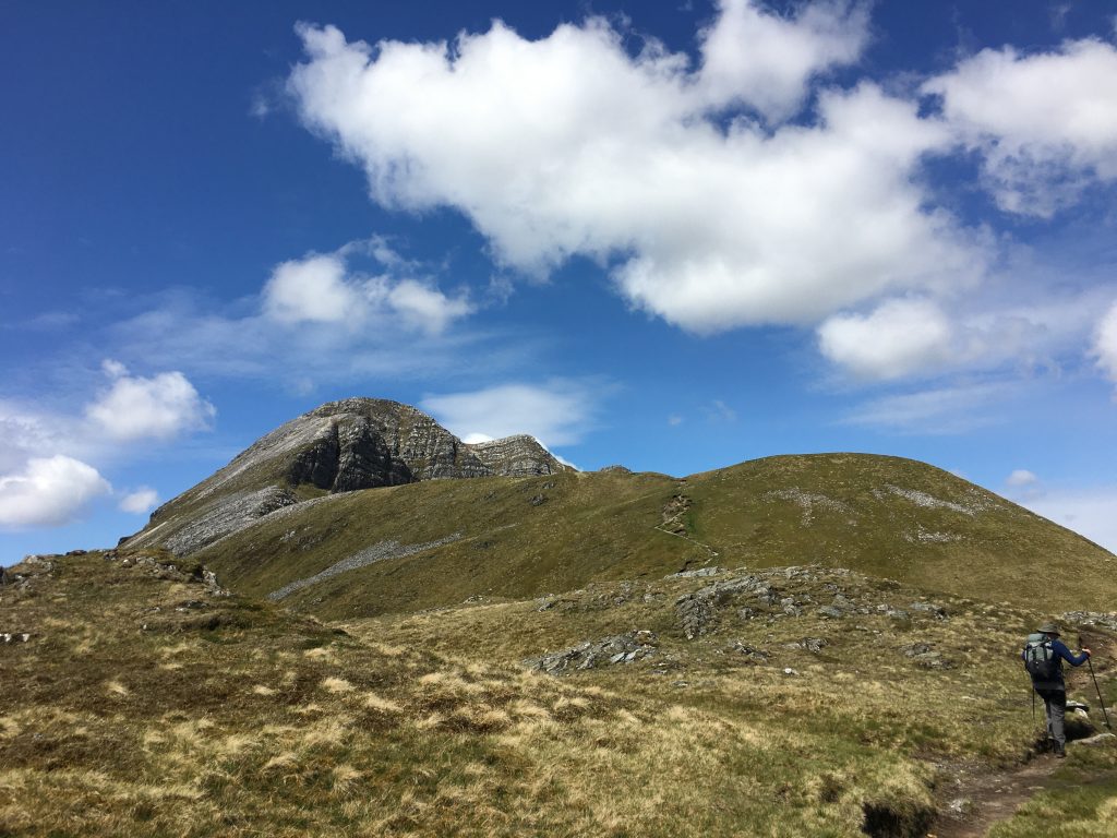
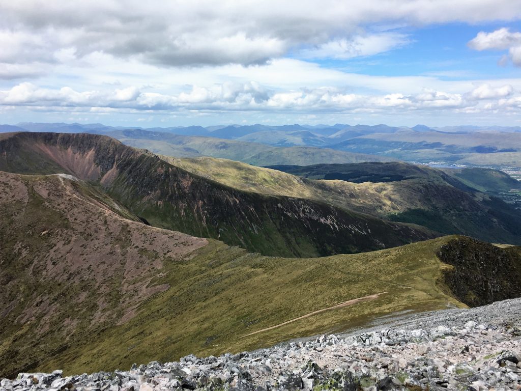
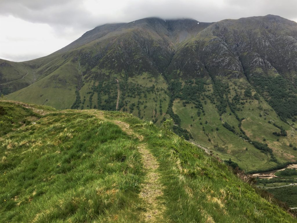
Looking up the valley from the campsite you can see the white topped summits of Stob Ban and Sgurr a Mhaim giving the illusion of snowy tops. In fact you are seeing the reflective quartzite stones that are exposed on the tops of these munros.
The very useful walkhighlands.co.uk website (I strongly recommend it to anyone walking in Scotland) had a route guide that described a circular walk that took in the southernmost of these summits (Stob Ban) and as the sun was shining it felt like a nice mountain walk to get our legs going in advance of our hoped for (but not achieved) Ben Nevis ascent later that week.
Yet again we started on the bikes, leaving them, our helmets and our smelly old trainers at the Polldubh carpark to wait for us to return from our walk.
We ascended the clear path alongside the Allt Coire a Mhusgain that led up the valley to a bealach (mountain pass) between the two quartzite topped peaks. We were feeling rather over equipped as we were passed by a couple of fell runners on their way up, and then another runner on his way down.
The path to the Bealach got steadily rockier the higher we got
Further up the path we came across a phone dropped by the runner we had met – he was too far down the hill to catch by this point, but we managed to track him down by answering some of the calls that came through. By the end of the day I felt as though I had taken on a secretarial role for his scaffolding business. Later that evening he popped by the pick up his phone from the campsite.
Looking back down the valley
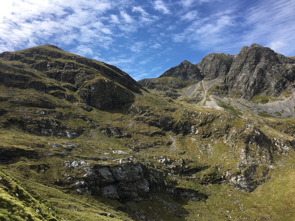
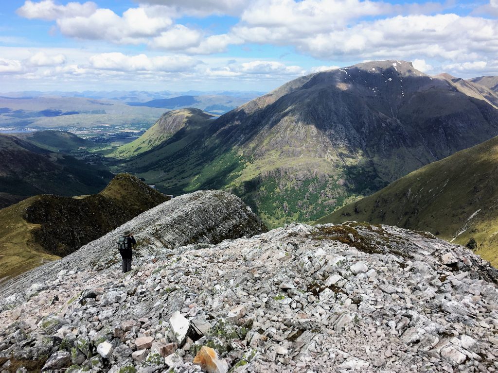
From the bealach paths head off in all directions, we took a right turn to climb the shattered quartzite bulk of Stob Ban. From here the clear blue skies allowed us to see mountains in all directions. A truly beautiful sight of summit after summit, ridge after ridge. How I miss the mountains!
Heading towards the summit of Stob Ban
We wandered around the ridge to the next summit before dropping back down to our parking spot.
Quartzite on the summit of Stob Ban
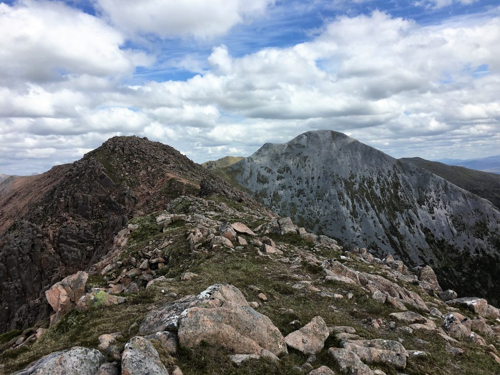
Following the ridge
Mountains everywhere
On the way down the path got increasingly boggy and steep until we hit the forestry paths, but a bit of bog has never stopped us and the spongy grass was welcome relief from the rockier sections of the path.
I had been a bit nervous that the cycle back might be a slog, but it gave our walking muscles and sore feet some rest plus there was the pub at the end for a cold beer. A perfect mountain day.
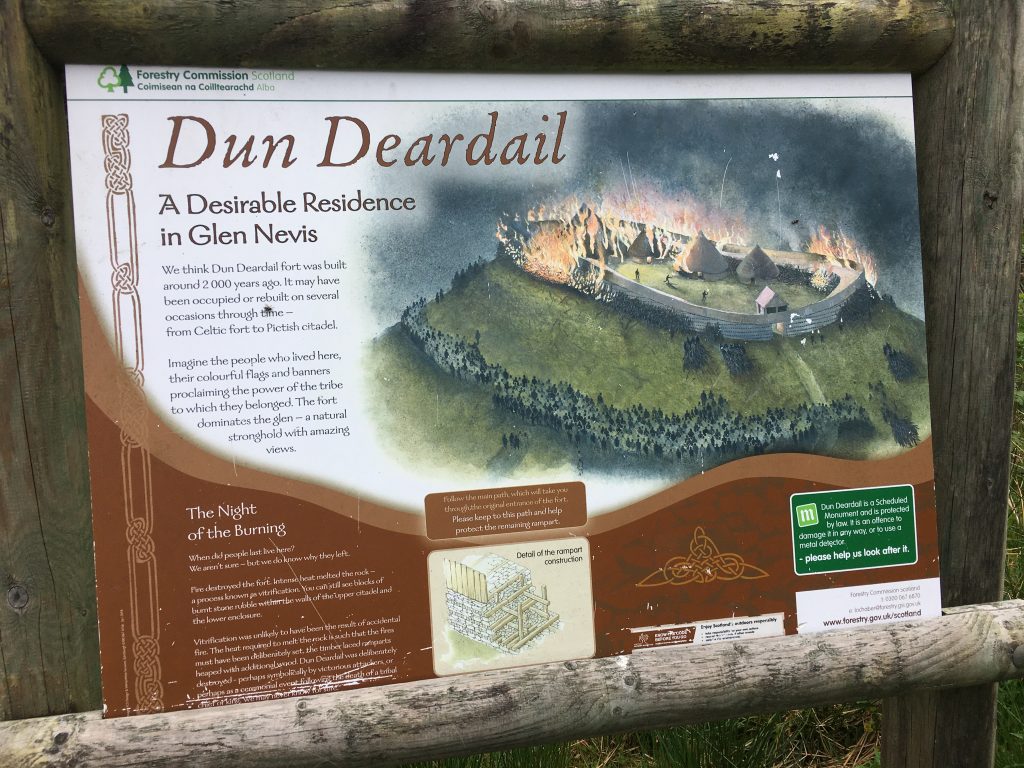
Dun Deardail Fort
After our climb of Stob Ban, Paul’s legs were feeling a little tired. The weather had started its turn towards more typical Scottish cloud and drizzle so he wasn’t very motivated to get out. However I was feeling stir crazy in the van and a couple of wanders around the campsite weren’t doing it for me.
So walkhighlands came to the rescue again with a short walk on forestry tracks to the fort of Dun Deardail hidden amongst the pines.
As usual when I’m on my own with no one to talk to I stomped rapidly along these paths up to the iron age hill fort. Meeting lots of West Highland Way walkers on their final stretch of the route to Fort William. The slow zig zag of the forest tracks can occasionally be bypassed by narrow trails that cut more steeply up the hill through the mossy mystery of the forest. Every now and again the view opened up towards the mist shrouded bulk of Ben Nevis and the valley.
Mossy secret paths through the woodland
Dun Deardail is well signposted from the track and despite being hidden by the forest it opens out so you can clearly see and walk around the grass mounds that mark the vitrified rampart of the 2000 year old fort.
Lower slopes of Ben Nevis from the wall of the fort
All in all a good leg stretcher of a walk.
A Circular Cycle Route
This route was going to take us up the forestry trails, past Dun Deardail fort where I’d been a couple of days previously. This was pretty much the highest point before we started a descent into the next valley, following the forestry tracks as far as we could (and indeed a little further!) before heading off on the West Highland Way footpath.
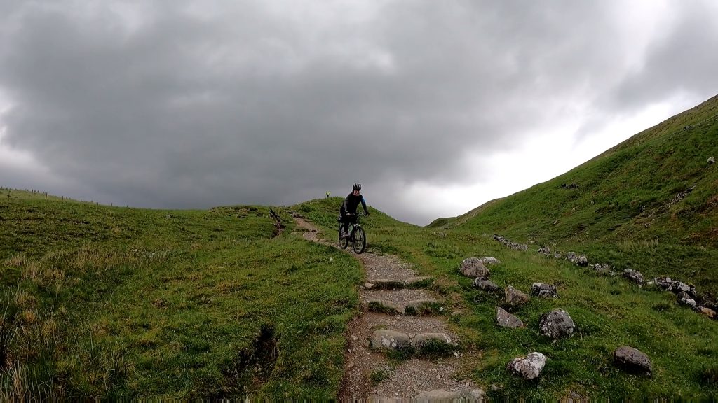
A few cyclable steps on the West Highland Way
We were early enough on this route to avoid most walkers. We knew that plenty of people do cycle along here (and some do the whole of the WHW by bike) but if you had been later in the day it would make a very stop start affair. As it was the path was a pleasing bit of single track with a few sections of pushing/carrying up and down steps where it crossed streams.
The downhill section of the West Highland Way
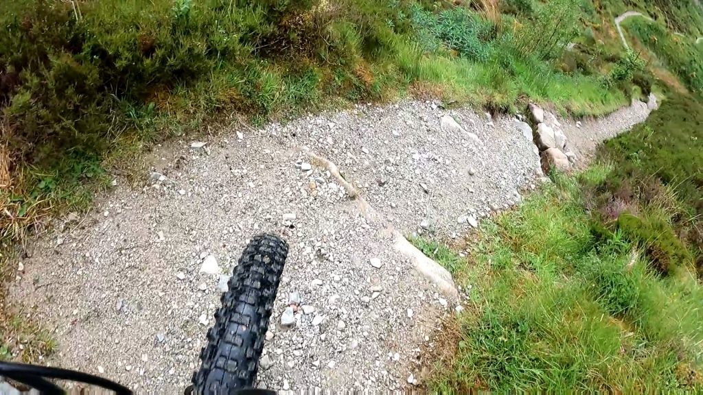
We had intended to carry on along the Old Military Road from here as far as we could. On the map it looks fairly flat. In reality it was a bone jarring monstrosity of a track at this stage. Large rocks and pebbles made it feel like cycling along a dry river bed and we quickly decided to turn around again and pick up the tarmac road back to Fort William.
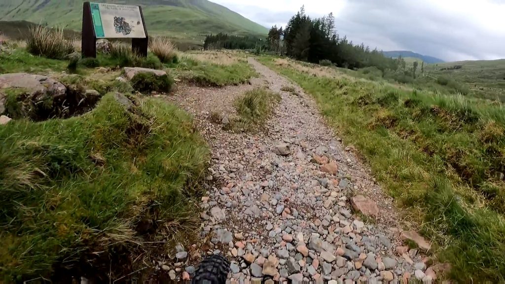
Stony track on the Old Military Road
This road went up and down, past a few houses and one group of lads filming a re-enactment of breaking bad for a stag do. A viewpoint by a play park was a final stopping point for a quick snack and views of the fast moving cloud hiding and revealing the summit of Ben Nevis.
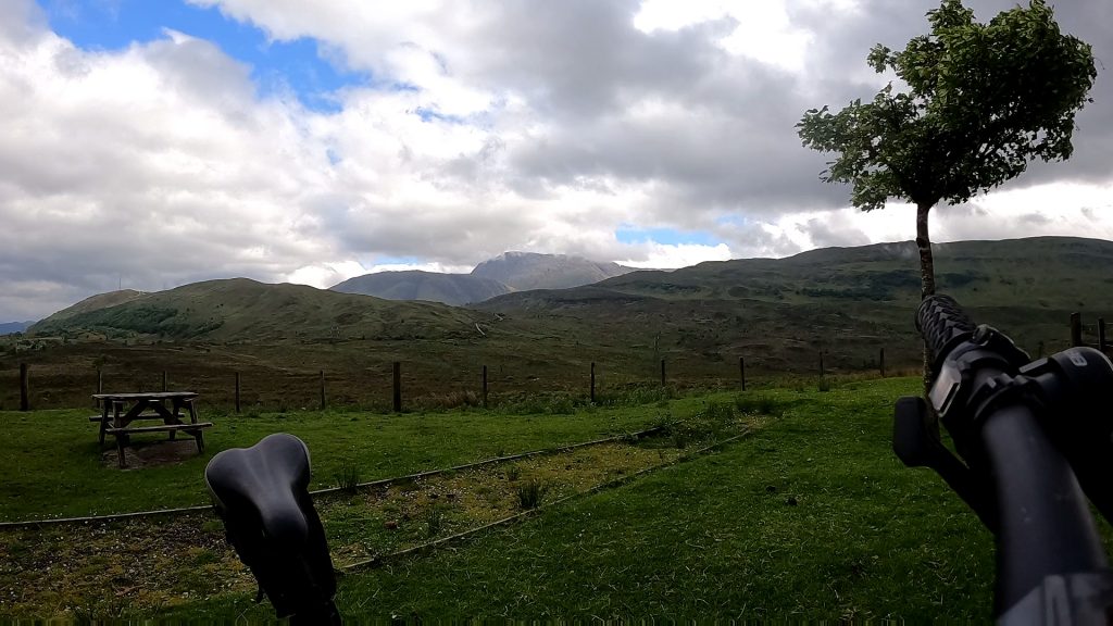
Watching the clouds above Ben Nevis
Finally we left the viewpoint and turned onto a track just before the outskirts of Fort William. This took us to the east of Cow Hill and over the ridge back into the Nevis Valley. The final descent was steeply steeply downhill. Needless to say Paul reached the bottom way in advance of me; the faces of the walkers I passed reflected the shock of an encounter with a speed mad cyclist (apologies to anyone who may have been traumatised by the experience) and the sweeping skid mark at the bottom of the hill revealed the emergency stop.
Walking along the Nevis Valley
As the weather closed in we decided our final walk would be a stroll along the Nevis valley. In parallel to the route we normally whizz (maybe a slight exaggeration) along on our bikes. We walked down the road to the Ben Nevis Visitor Centre where we had a little mooch around the shop before crossing the modern bridge to the other side of the river.
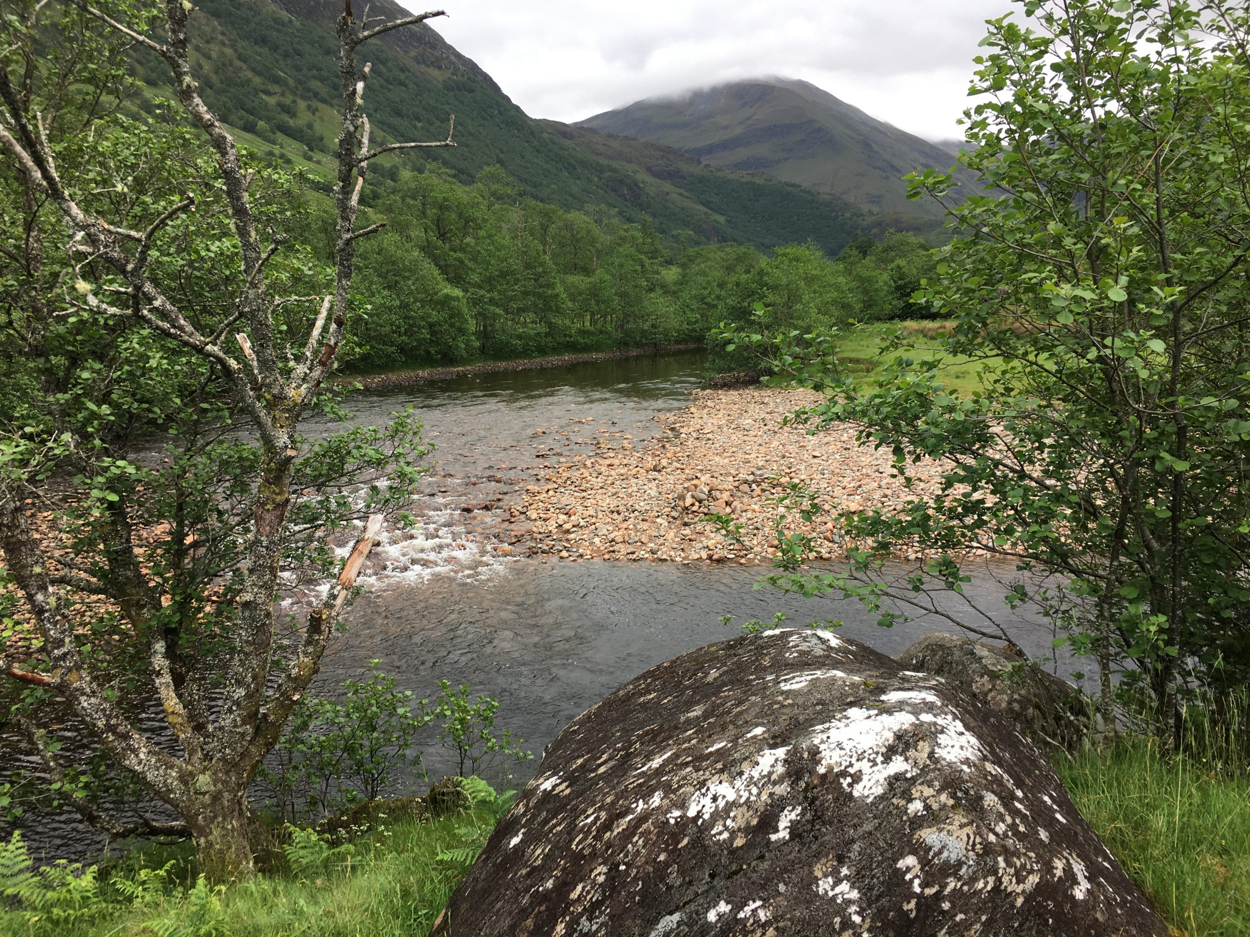
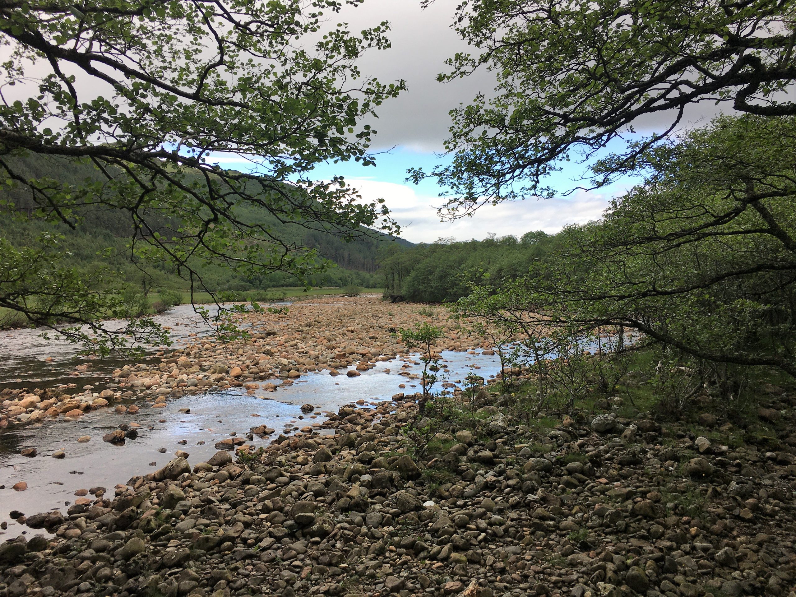
From here it was a pleasant walk initially along well graded paths suitable for wheelchairs ( we ignored the route up Ben Nevis which was very quiet today) and then on a slightly rougher path that followed the river, mostly close to the riverbanks but sometimes heading away from the meanders.
Along the route is an old burial ground thought to be the original burial ground of the Campbells of Glen Nevis surrounded by low stone walls and flanked by overgrown trees and further towards the Polldubh Falls a couple of old and seemingly abandoned cottages served by a track that took us back to the road and the falls.
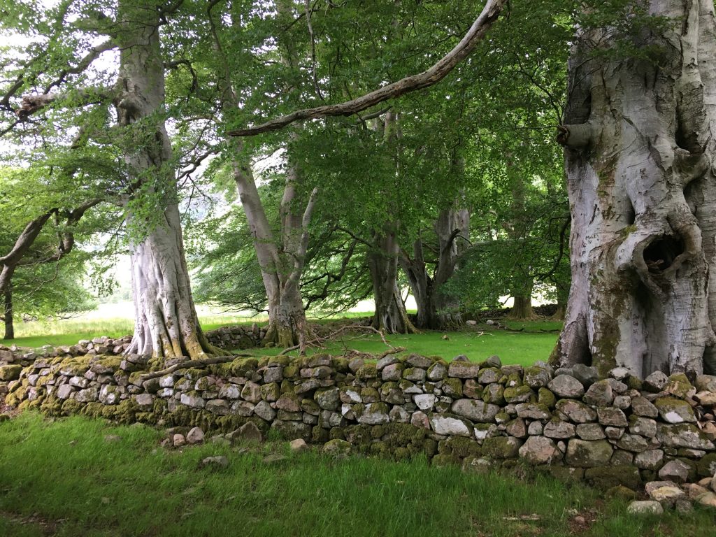
The old graveyard