
23/08/2025
After leaving Mosjøen we were heading to somewhere that’s been on our wish list since we started planning this trip. Svartisen Glacier. We love glaciers and we’ll take any opportunity to visit them. Svartisen is actually two glaciers separated by a huge cleft in the mountains. We were heading to the eastern glacier and it’s glacial arm Austerdalsisen, which can be accessed off the E6
Getting to Austerdalsisen
We briefly stopped at Mo i Rana to do our services (get rid of the toilet waste and waste water and fill up with more water). One of the joys of the E6 has been all of the free motorhome service points along the way. This is such an easy country to enjoy by motorhome. It doesn’t mean that we’ve had loads of free stopovers, most have had some kind of price attached, but it does mean that towns, villages and tourist attractions can offer overnight parking without having to worry about installing their own service points.
Just North of Mo i Rana we turned off onto the minor road that leads up to Svartisen Rana. The road was a little uneven in places, but generally just wide enough for two vehicles to pass each other slowly. It crept up to the lake of Svartisvatnet following the river all the way. Just before the lake and camping spot the road becomes a private toll road. We didn’t have to pay on the way up, but did need to make sure we paid within 48 hours of leaving. This all worked on numberplate recognition and the 150 NOK payment was made on the YouPark.no website. Easy peasy.
Camping at Svartisen Rana
At the top of the toll road was a large car park and initially we parked here, but after getting out and wandering around we realised there was a camping area next to the lake. It was very muddy and the ground was only solid in a few places but we managed to find a spot we felt confident in and it was much nicer than being in a gravel parking lot. We found out that the camping area had been flooded only a couple of weeks earlier. In the warm weather, when there is a lot of glacial meltwater, the level of the lake can rise. No wonder the ground was so soft.
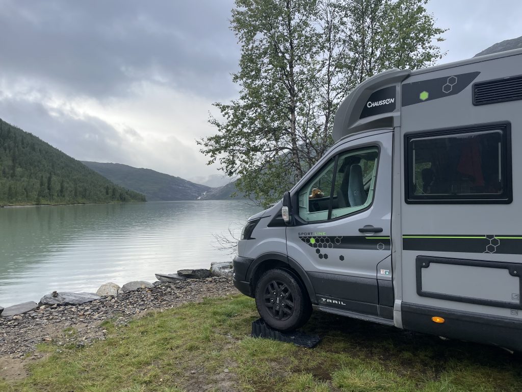
Parked up at Svartisvatnet
This might be called a campsite but it’s the most basic kind. Rustic toilets of the long drop variety had the usual unique odour that even the line of a dozen air fresheners couldn’t touch. There was a fresh water tap and an outside cold shower if you were so inclined. Yet again we felt a little smug with our on board facilities and despite the rudimentary nature of the camping it was in a lovely location.
-
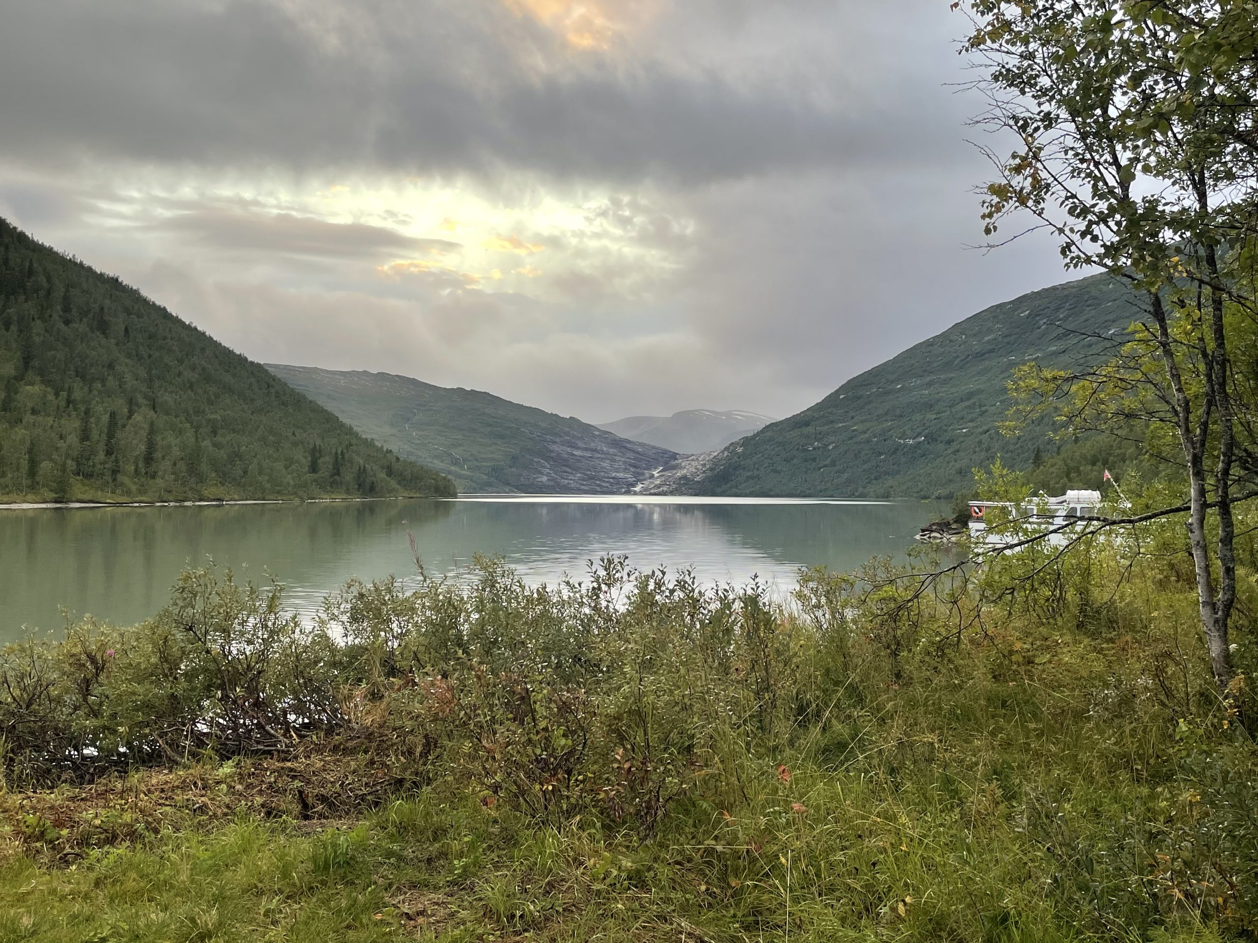
- Daytime view
-
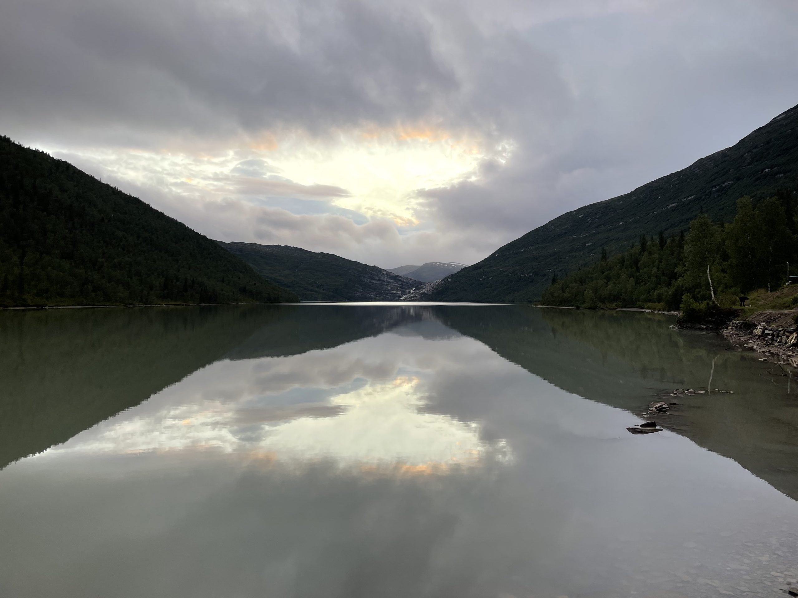
- Evening view
At about 9pm the owner did a walk around and took our payment. If you decide to get the return boat trip to the end of the lake (which we now would recommend) then you get the camping for free. It’s 315 NOK for a return ticket per person. The camping is 200 NOK. Being cheapskates, we decided we would walk alongside the lake.
Getting to the Glacier
The route to the glacier goes something like this:
Part 1: Get to the end of the Svartisvatnet lake
Part 2: climb up beside the waterfall to the next lake (Austerdalsvatnet)
Part 3: Clamber across the rocks to the foot of the glacier.
It’s about 7.5km in total (so 15km there and back), of which 4km is walking alongside Svartisvatnet. You can cut out the 4km lakeside walk by taking a boat from the campsite to the far end of the lake.
We didn’t think it was worth the money, 4km alongside a lake on a fairly level path wasn’t going to be much of a challenge. After the first couple of kms we changed our opinion completely. The path alongside the lake was like finding a route through a jungle. The ground was boggy, there were roots and fallen trees to clamber over. We had to go up, down and around obstacles. For a while it was interesting and fun, then it just became tedious. We wished we’d paid the money and taken the boat, leaving us with more energy for clambering over the rocks by the glacier. We were very glad we’d thought to wear our gaiters which allowed us to walk through the bogs without having any worries about wet feet.
-
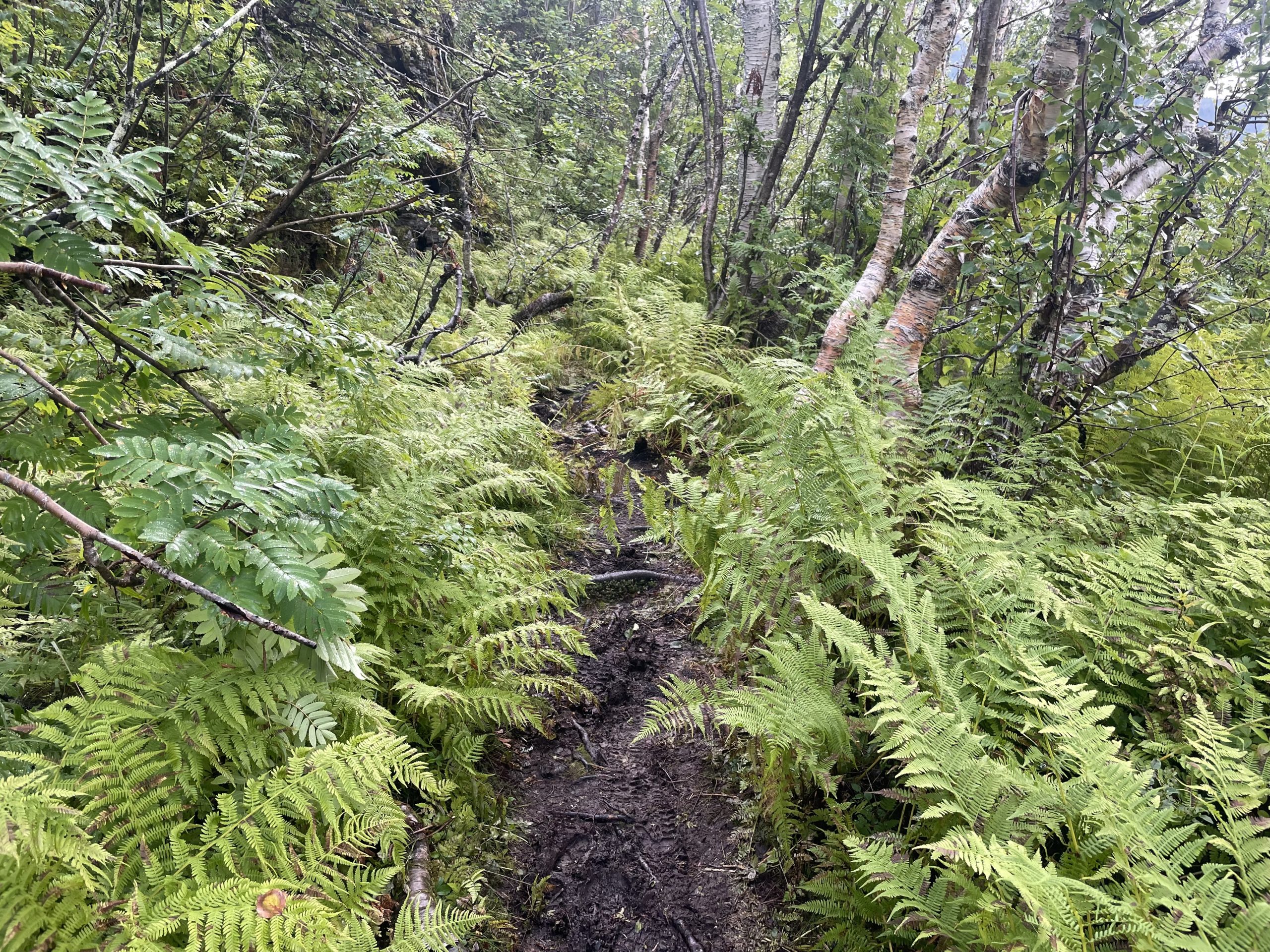
- Through the jungle
-
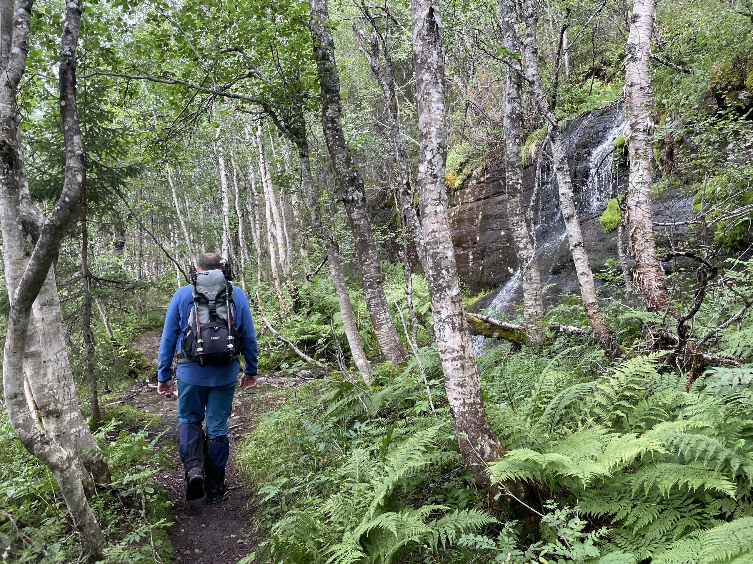
- One of the clearer paths
-
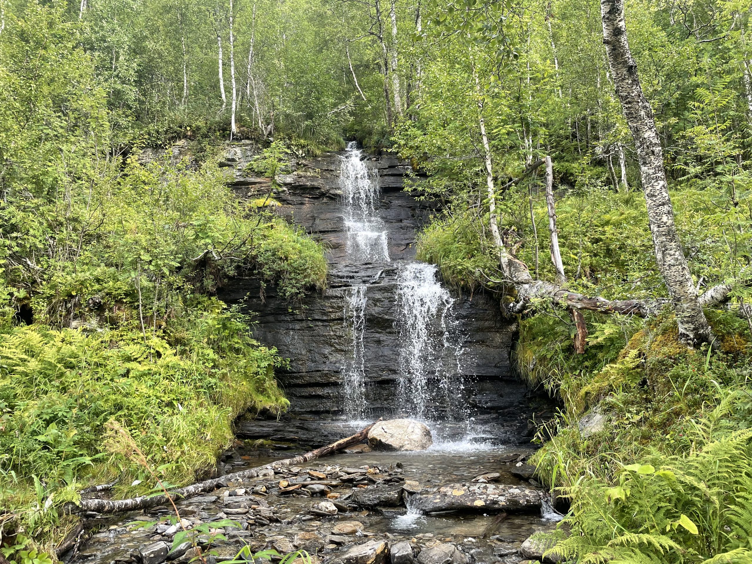
- There were a couple of nice waterfalls
-
- Relieved to be out
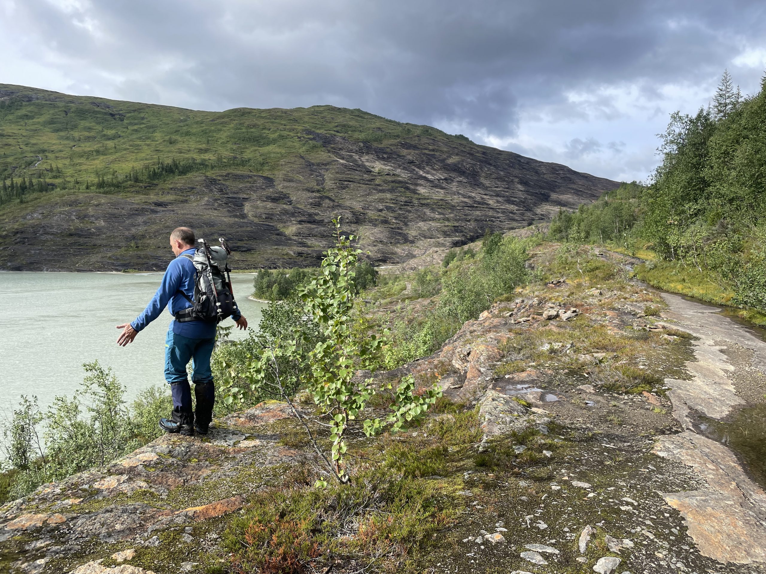
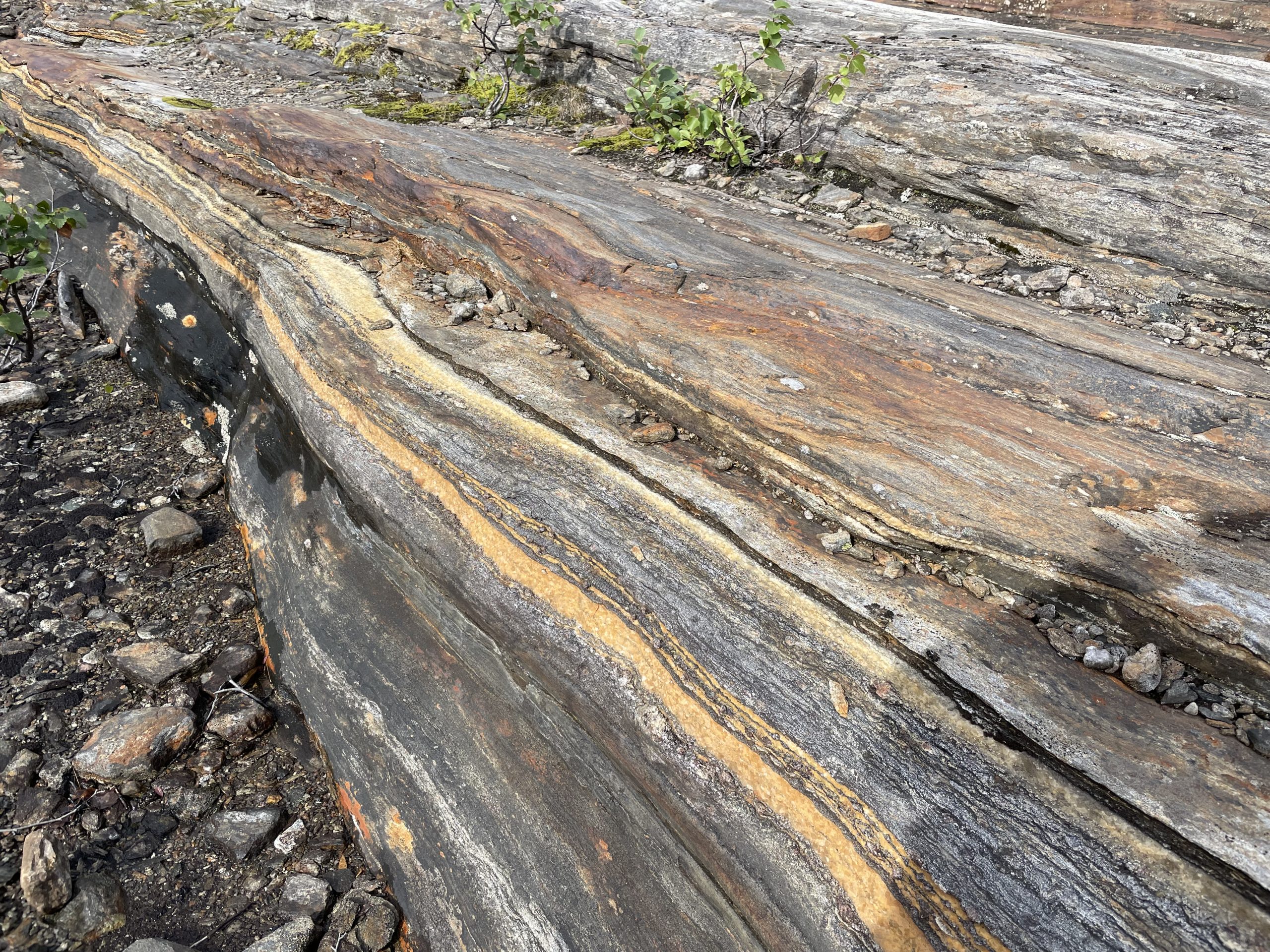
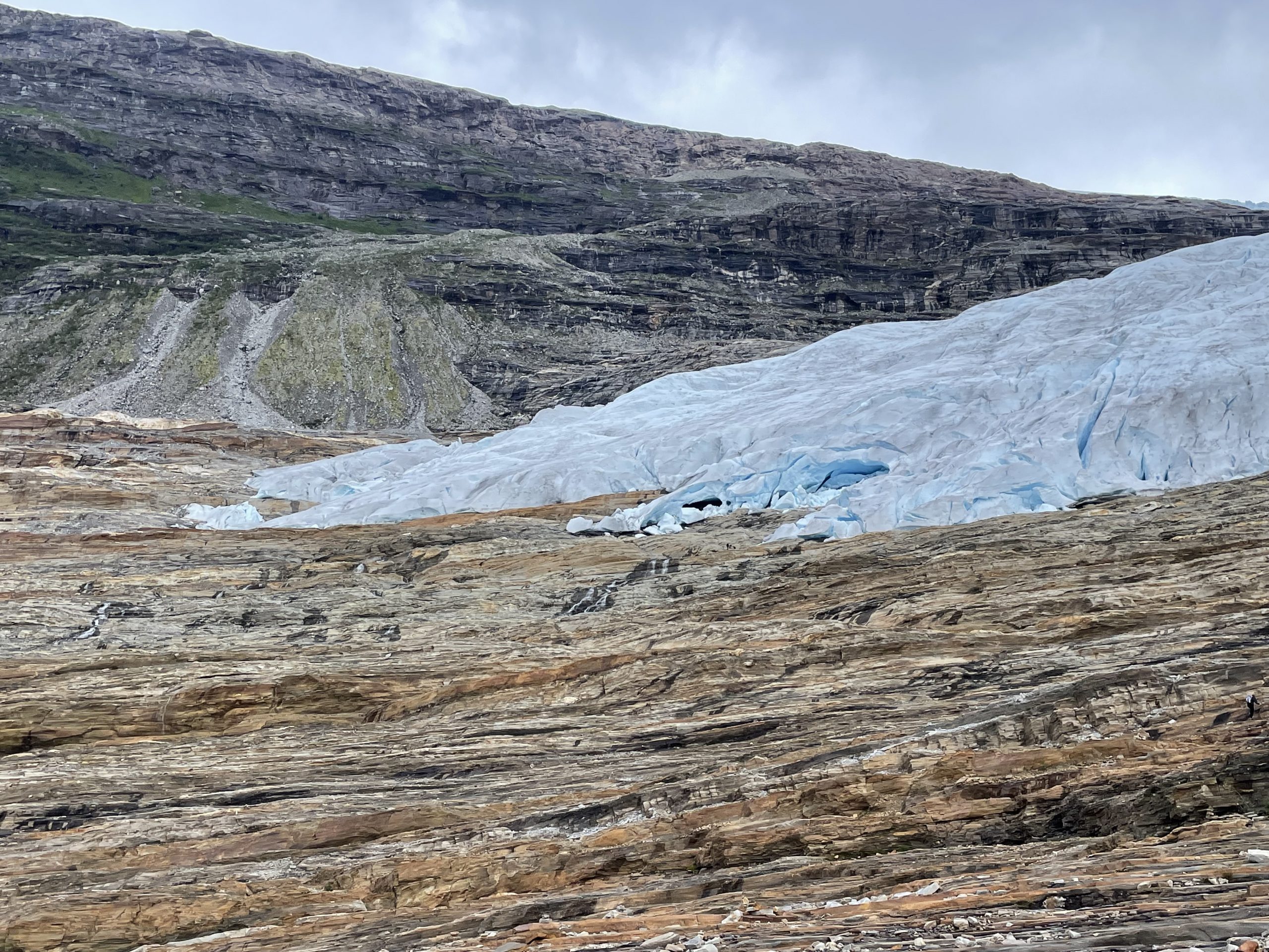
It was a relief when we finally exited the woodland by the lake and were able to ascend the rocky path by the waterfall. The rocks here, scraped clean by the glacier however many years ago and polished to a glossy amber, are a spectacle in their own right and we could have spent hours just exploring the rock layers.
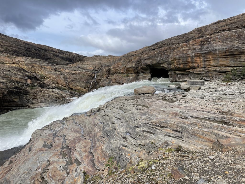
The top of the waterfall appears from within the rock. We have tried to work out whether this is man made or natural. There were the remains of old buildings nearby.
-
- Rocks
-
- and more rocks
-
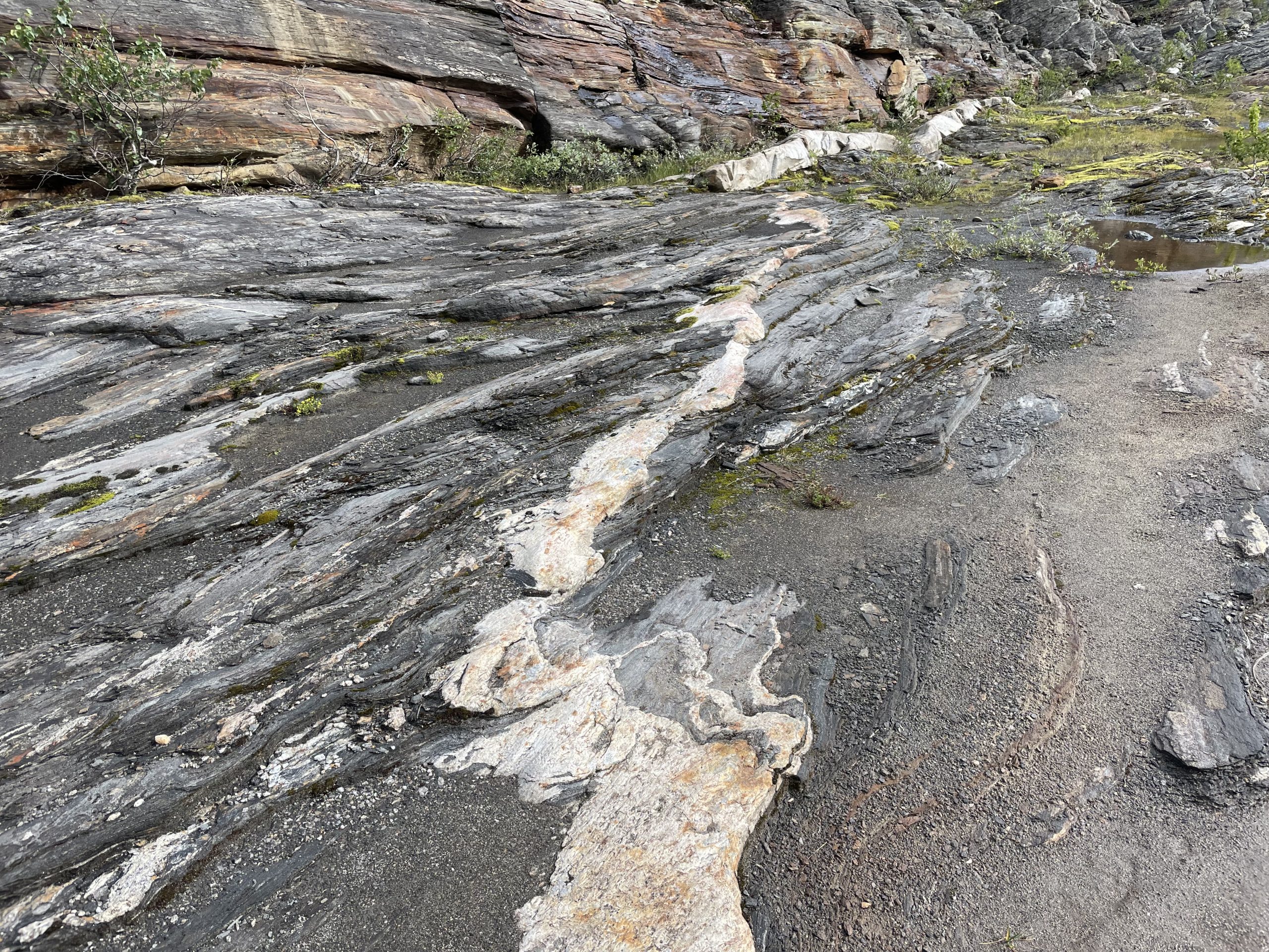
- including some veins of quartz
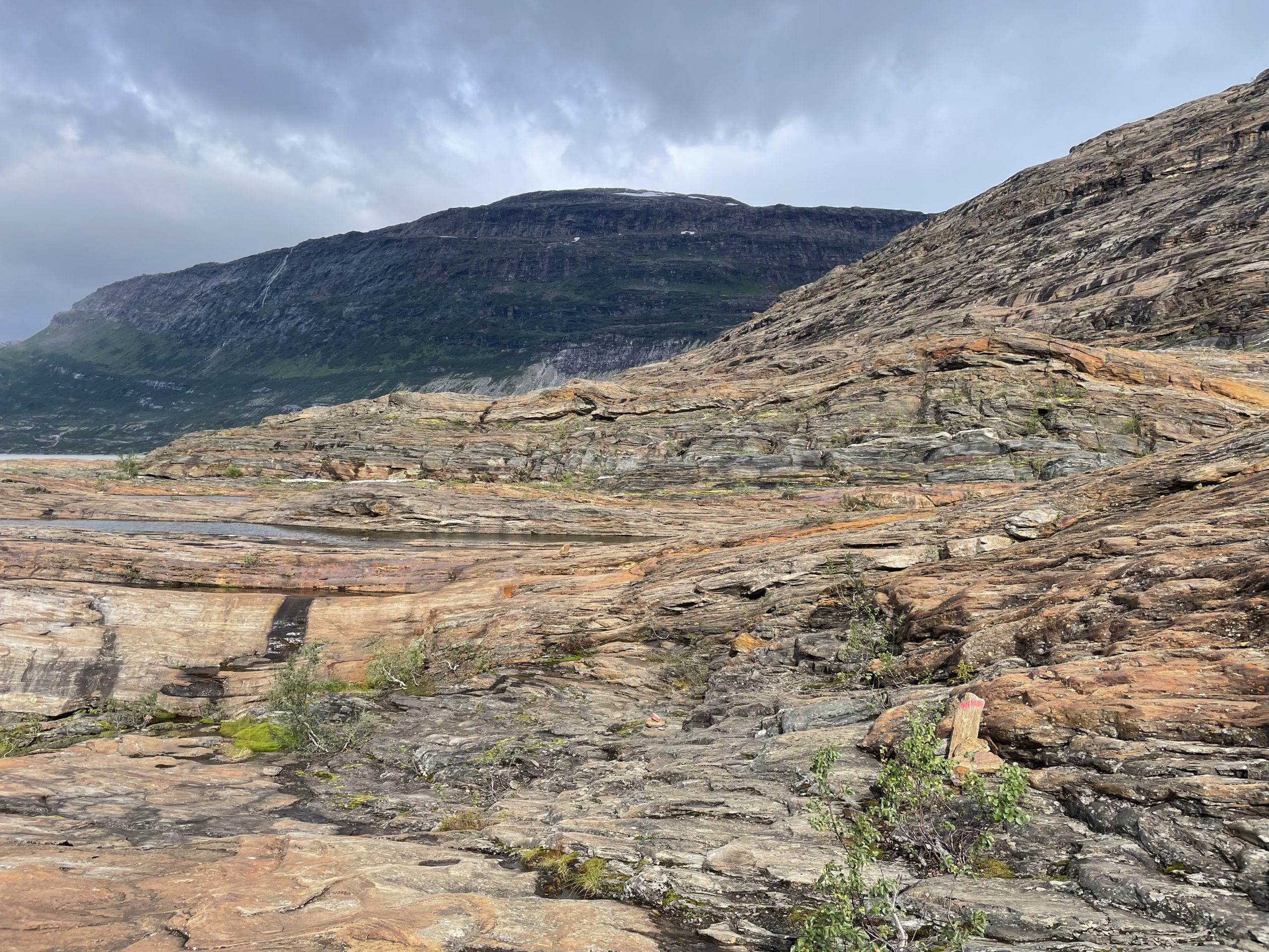
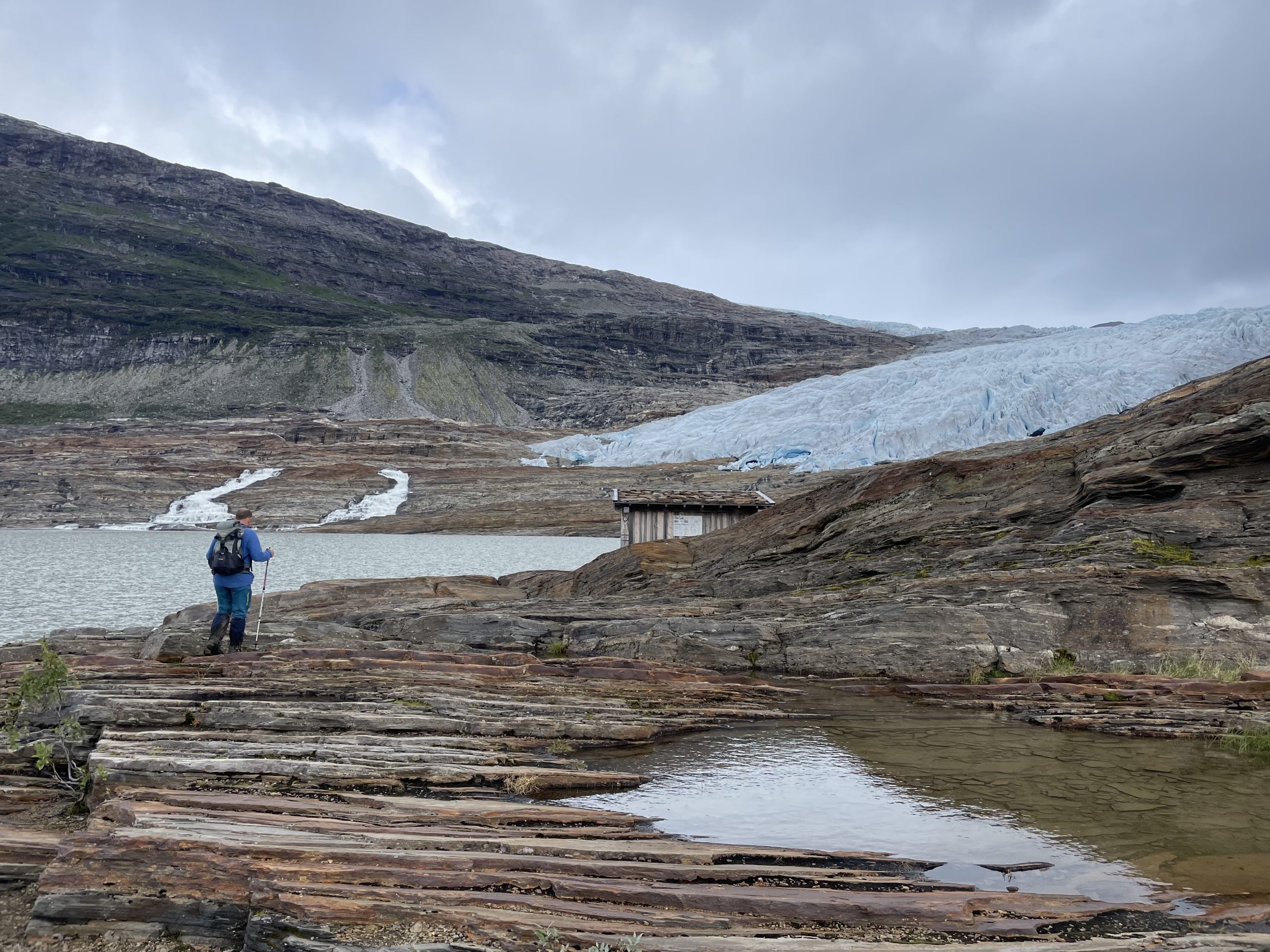
The Glacier
It took a while before we got any view of the glacier as we had to walk up and around the corner before it came into view. There was noticeable drop in temperature as we got closer though, with the cold air from the glacier sinking towards us.
The path is well marked with the red Ts (T stands for ‘tur’), red dots and cairns of ‘Den Norske Turistforening’ – the organisation which looks after trails in Norway. This trail takes you up to a shelter where you have a great view of the glacial tongue. We stopped here for a while to eat our packed lunch. We got close up views of the glacier through our binoculars which I would recommend bringing along if you dont feel you’ll have the energy to get all the way to the ice.
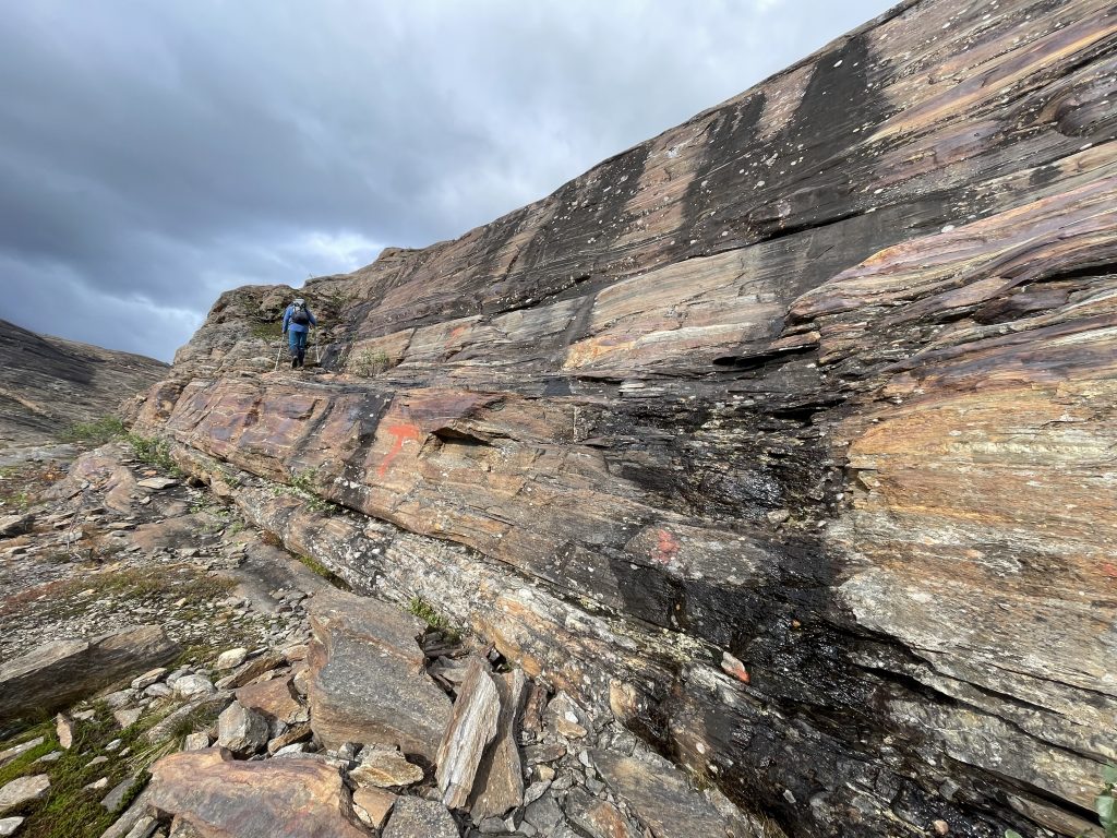
Climbing up one of the rock walls
Then you can carry on and climb over ramparts of rock towards the glacier itself. Here route finding got more complicated. Cairns mostly indicated the route, allowing us to determine where each layer of rock could be most easily ascended and descended. Unfortunately there also seem to be a lot of additional cairns and so it can be easy to follow side routes and end up at dead ends. Some people were going right to the edge of the glacier, but we were happy to keep a healthy distance, mostly because our legs didn’t fancy going much further.
Sadly the glacier is retreating, photos back at the campsite will show just how much it has reduced in the last 100 years.
One benefit of not getting the boat was that we didn’t have to rush back to the jetty for the return. We could see people getting quite worried as they tried to get back across the rocks and had to double back on themselves. We found somewhere to perch and watched the ice, mesmerised by it’s colours and shapes.
Return to base
We walked back the way we had come, actually the walk by the lake felt a bit easier in this direction as we were going (minimally) downhill and also knew what we were expecting. We tried to stick closer to the lake edge so that we could walk along any beaches and avoid the bogs. It worked to a certain extent but it was still very muddy. When we got back to the car park a Polish coach had turned up – fair play to that driver – and a large group were making ready to head up to the glacier.
We were really happy that we’d made the trip up here. The walk was harder than we’d anticipated because of all the climbing around but we were pleasantly tired rather than exhausted, so we decided to drive on and find some free parking a bit further along our route.
Pingback: Starting the Helgelands Coastal Route - Taking the Long Way Home %
Pingback: Glacier Spotting in Jøkelfjord - Taking the Long Way Home %