
29/08/2025
After finishing my work meeting in Narvik we moved just a few kilometres, with a quick interlude at a supermarket, to a parking spot on the E6. It was separated from the road by a low rock mound which helped to block out some of the traffic noise. More importantly it was the start point for a hike up a mountain. This was to be our first mountain walk of the trip.
We drove over the impressive Hålogalandsbrua which is a fairly recent addition to the E6, which used to go around the edge of the fjord. There is a toll on this bridge (collected by our trusty toll tag) which goes towards to paying off 850 million NOK of the construction costs that was agreed to be funded through tolls. The rest of the cost was funded mostly by central government and Narvik shut it’s airport as part of the deal due to the decreased road travel time. I wonder if Narvik are regretting that now given that they’ll be hosting an international sports competition.
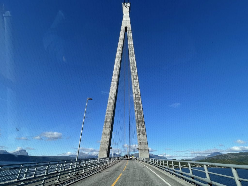
Roadworks on the bridge held us up for a few minutes. Watching the two workers trying to put the traffic lights in place was like watching the Chuckle Brothers
Spanstinden Parking
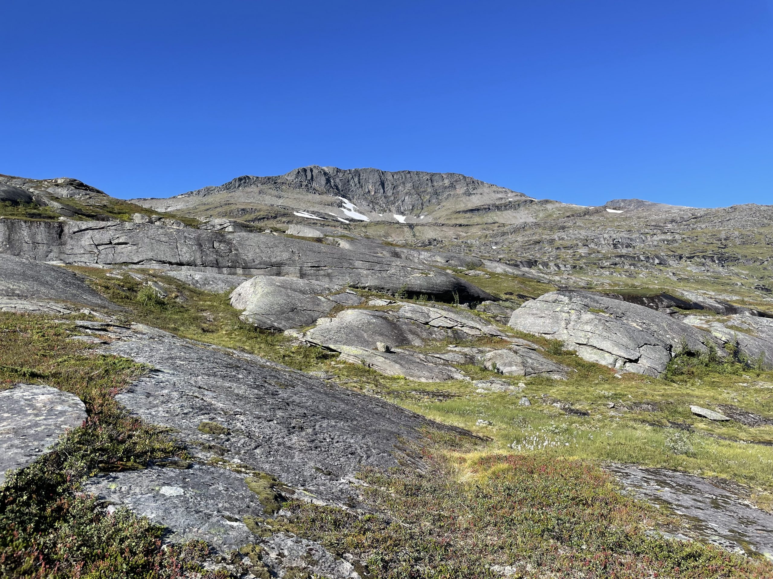
Spanstinden is the highest mountain in the area with a summit at 1457m above sea level. Although it’s taller than Ben Nevis it doesn’t even make it into Norway’s top 50 highest mountains, most of which are in the high altitude centre of Norway and a bit further south of our position.
Our overnight parking spot was at the start of the main trail up the mountain next to a large lake – Bukkemyrvatnet (vatnet on the end of a place name signifies a lake). That evening we had a scout around the local area for a lake that might be suitable for swimming but all of the nearby lakes/pools were very marshy around the edges (myr in the place name meaning mire or, more prosaically, bog).
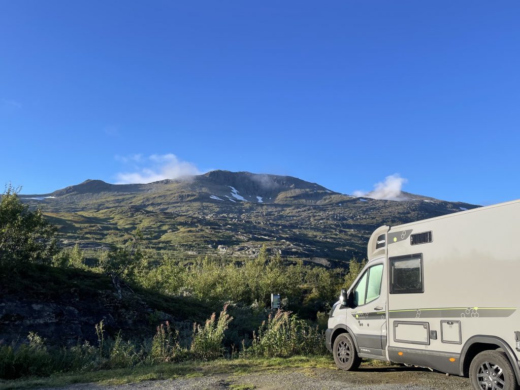
Our park up, the mountain we are climbing is on the right with a little cloud on top
Obviously as it was just a car park the parking didn’t have any amenities but it was in a lovely location. Another van joined us but squirrelled themselves away down a track. Overnight two cars arrived, their occupants sticking their internal silver screens into their windows and sleeping in their cars overnight. We thought they might be planning to climb the mountain but they drove off in the morning.
UT.NO
The following morning we set off to climb this mountain.
We have been using the UT.NO app and website to plan a lot of our walks and bike rides. The app is useful for maps when out and about, but sadly the walk descriptions are not in English (and you cant even select the text in the app to translate it). The website can be auto translated in a browser though, so is great for the pre-walk planning.
UT has a grading scale a bit like skiing; Green is easiest, then Blue, Red and finally Black. This was a Blue trail. The app describes a Blue trail as ‘Hikes suitable for moderately trained hikers with basic hiking skills and some experience in the terrain. The hike usually does not exceed 10 km in length and 600 meters of elevation gain. Primarily moderate ascent, but may have some steep and airy sections. The hike may contain rocky and gravel surfaces. Only easy wading.’. Given that this hike was over 11km long and over 1000m elevation gain I think the guidance is a little elastic, the terrain certainly wasn’t too challenging and there wasn’t any wading at all.
Climbing Spanstinden
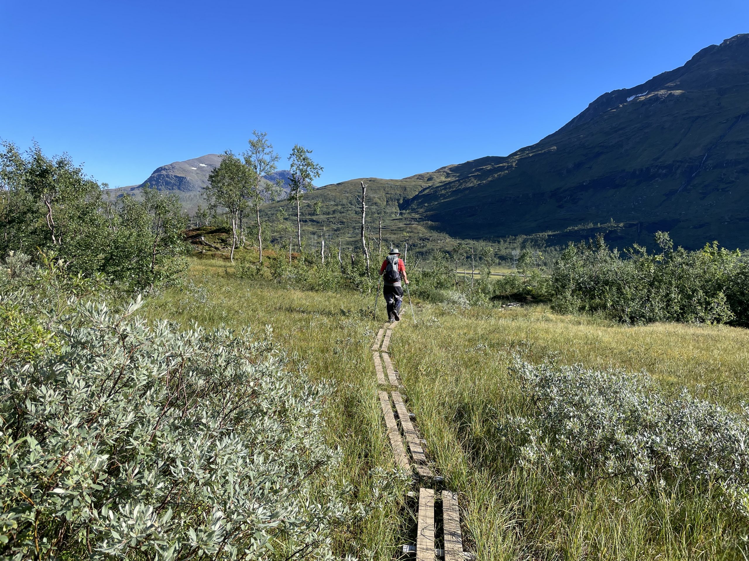
The walk up Spanstinden starts from the car park next to a noticeboard. The path is very obvious and took us through the aforementioned mire, duck boards helping with the crossing of the more boggy patches. The vegetation around us was lush grass, scrubby trees and many many bilberries in low growing bushes. It was a total distraction as I couldn’t help stopping to pick along the way, ending up with tell-tale purple fingers and probably a purple tongue to boot.
Lots of small brown birds flitted around us, startled from their cover and making a peep peep. I got out the Merlin app and they were identified as Meadow Pipits. Later we saw a ptarmigan, camouflaged against a stony backdrop.
-
- Boggy ponds…
-
- …and boards for crossing the mire
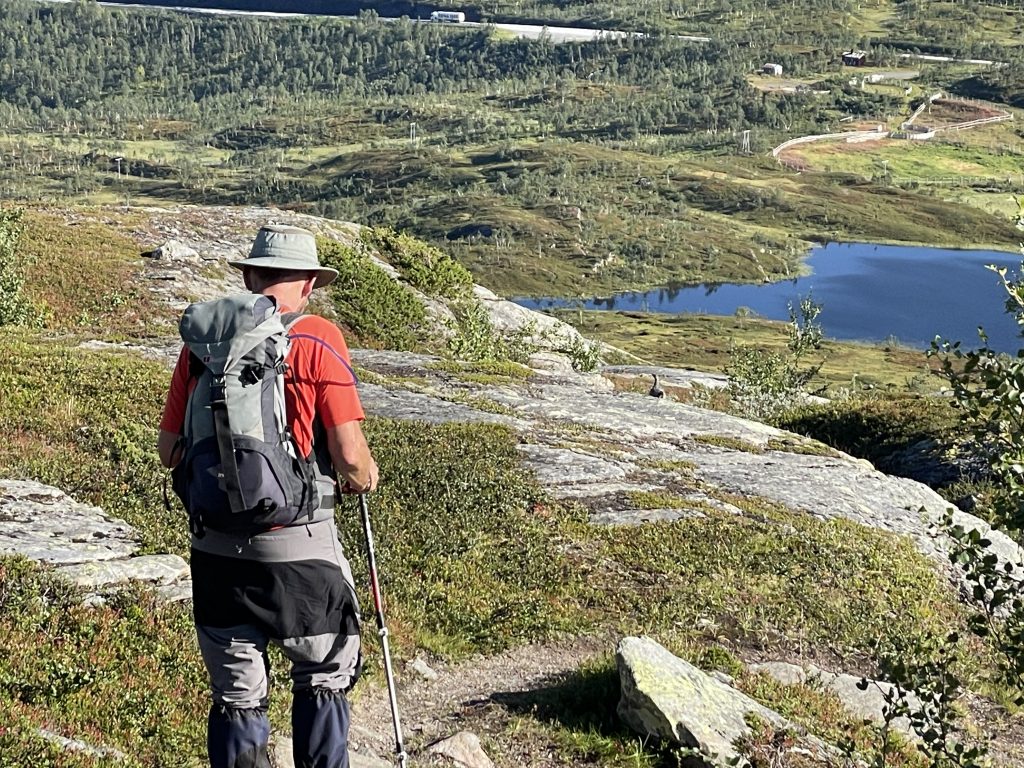
After the wetlands the path climbed terraces of rock, each terrace of grippy rock climbed by mostly easy paths and steps (just a couple of places where we needed to use our hands), with pools and vegetation on each shelf. Some seemed to have their own microclimates with geraniums, sedum and other rock loving plants in rocky nooks. On one of the terraces, just above a cliff that said ‘Base Camp’ in painted white letters a small lake was labelled as a ‘Swimming Pool’. We could have done with this the previous evening but we weren’t prepared for it on our walk which was a great shame. I said I’d happily take a skinny dip on the way down, but by the time we descended there were quite a few people on their way up and I lost my bottle.
-
- Rocky terraces
-
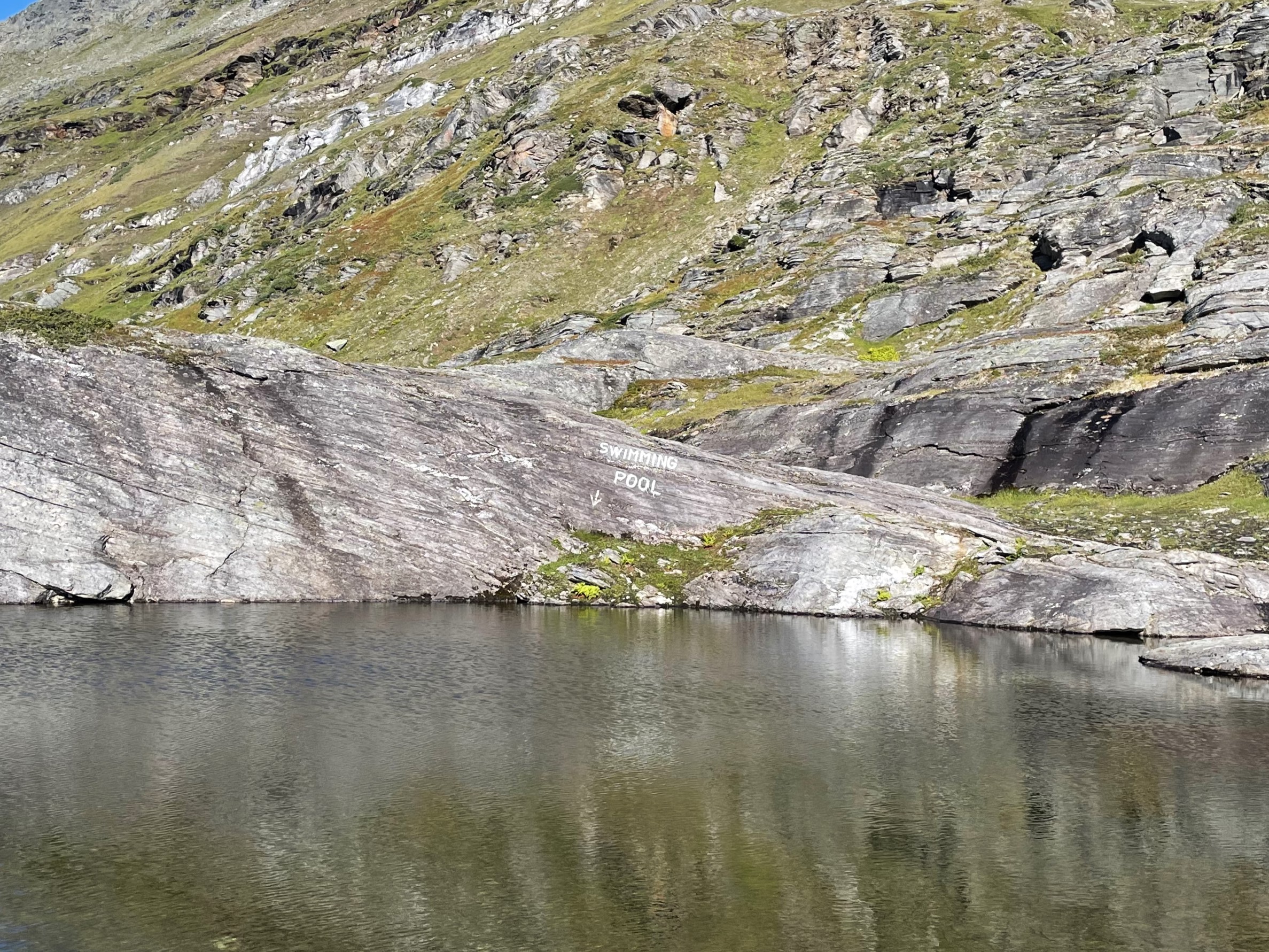
- A swimming pool
-
- Pools and cascades
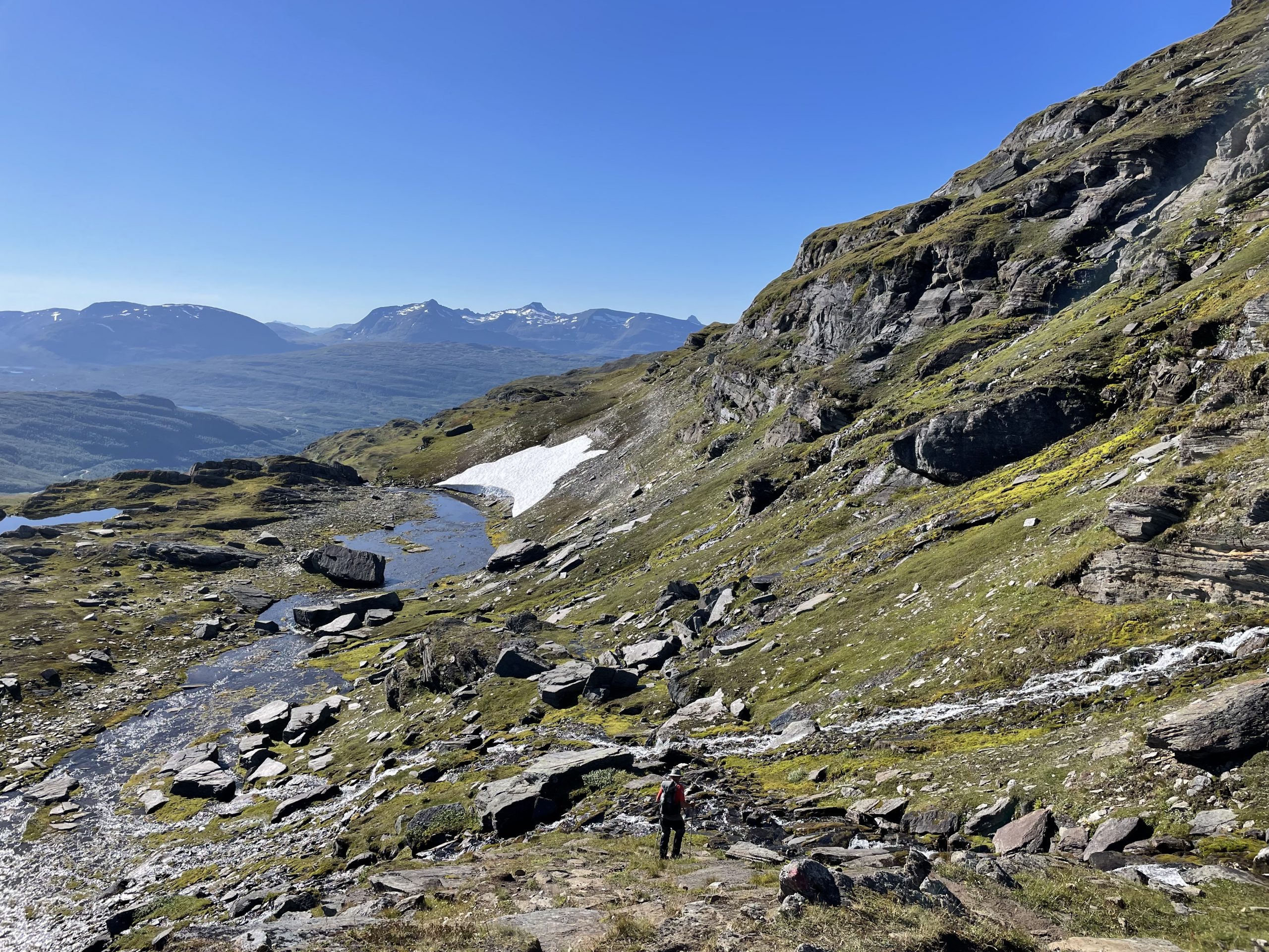
After the swimming pool we started to see less vegetation and more rock, even patches of snow that had persisted since last winter. As we crossed the snow patches we wondered whether they had been topped up with snow in the recent wet few days. When does a persistent snow patch become a glacier? (the answer seems to be related to there being sufficient accumulated snow for the lower layers to transform under pressure). And is there anywhere that glaciers are still forming? (amazingly the answer is yes, some due to local conditions and others, like a new glacier on Mount St Helens, forming due to catastrophic changes in the local geography).
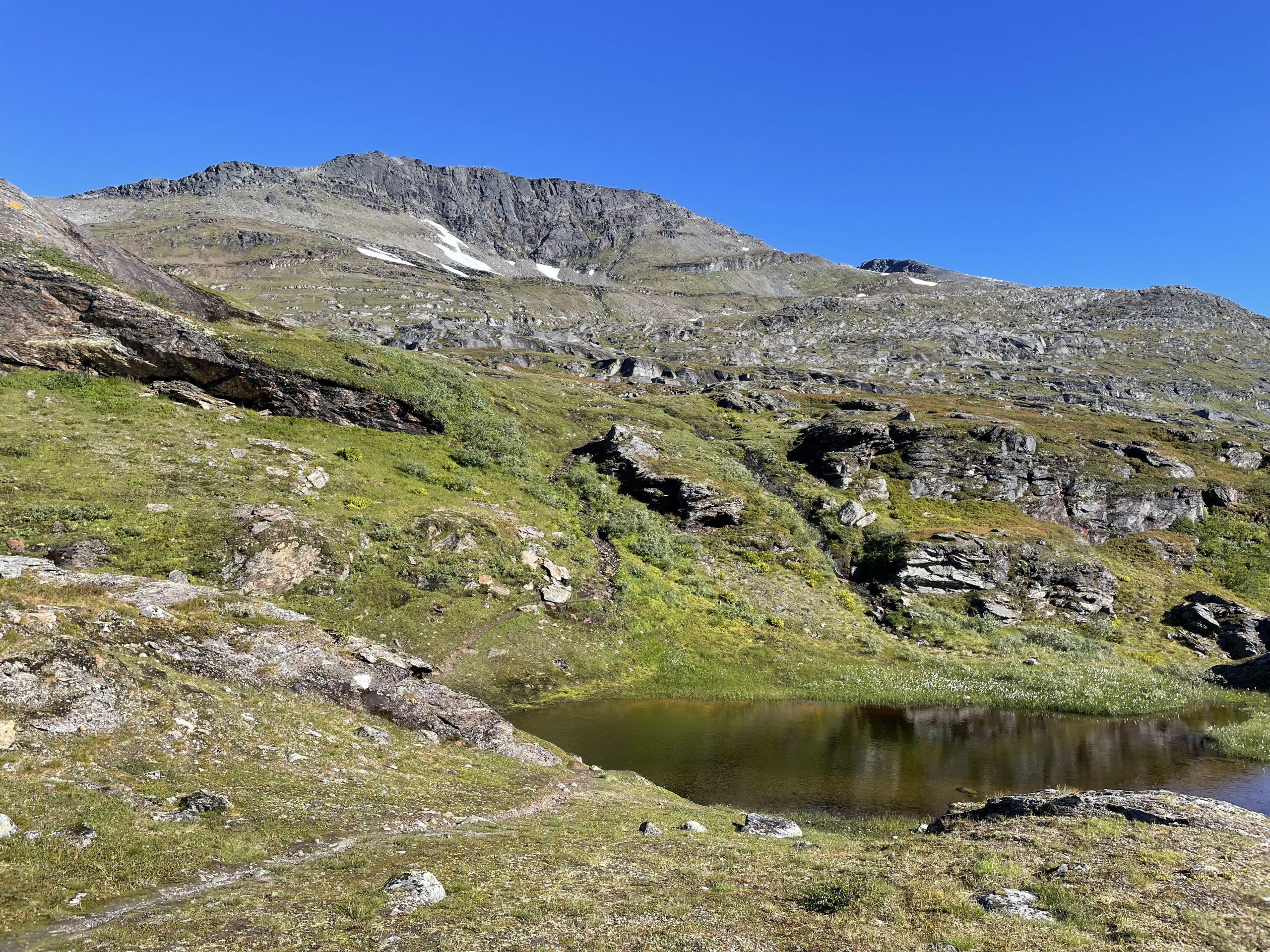
As we rounded the side of the mountain a slope of broken rock on the came into view ahead of us. We trudged up slope across the flat dinner plate sized slabs that moved annoyingly under our feet. At the saddle between Spanstinden and it’s neighbouring peak there were some lovely blue lakes to break up the monotony of this section before we resumed the climb.
-
- Rocks and snow patches
-
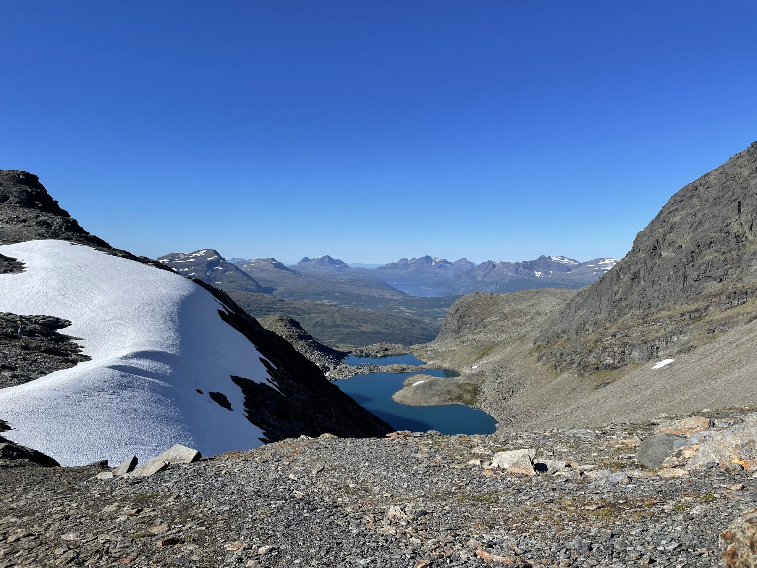
- Lakes
-
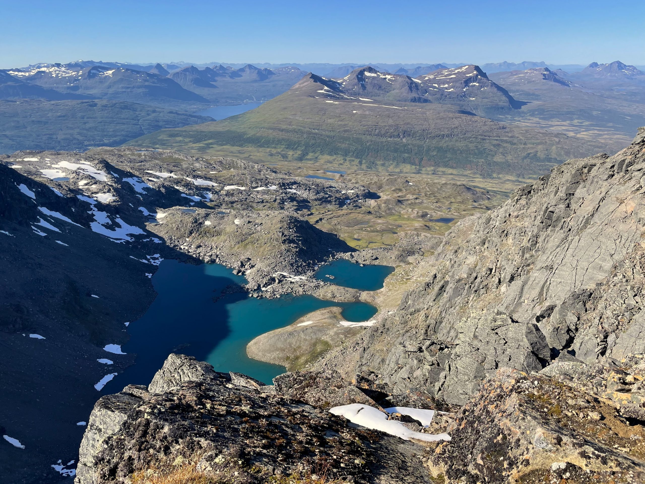
- And the same lakes from higher up
As we neared the summit that the ground flattened out a little and became less frustrating to walk on. We could see the summit cairn in the distance, a cone of rock for us to aim for.
-
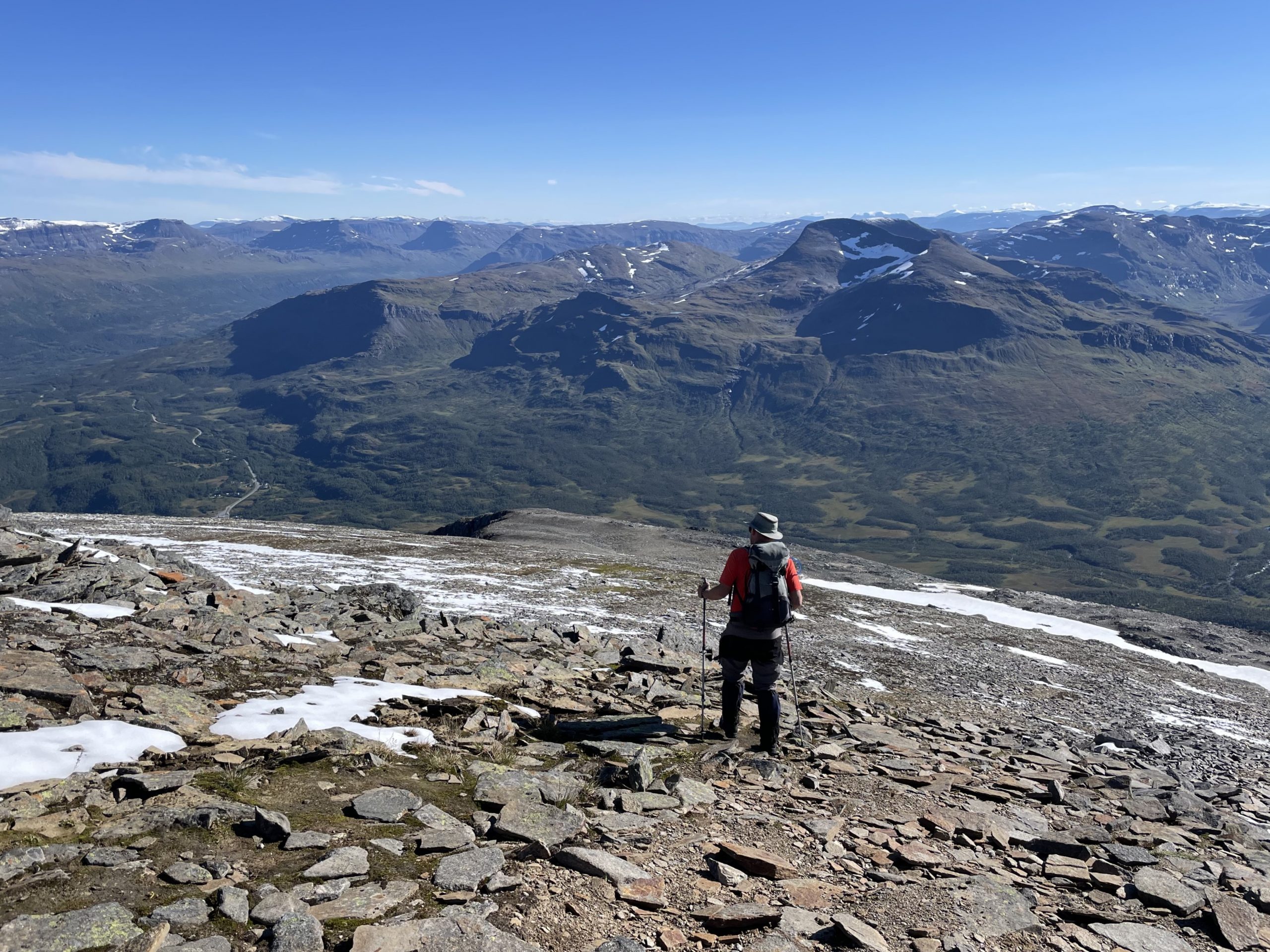
- The rocky ground flattens out
-
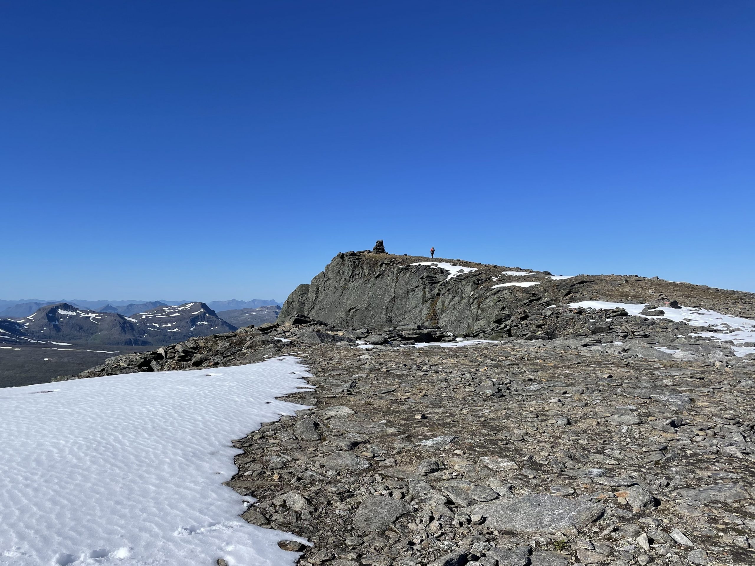
- The summit is in sight
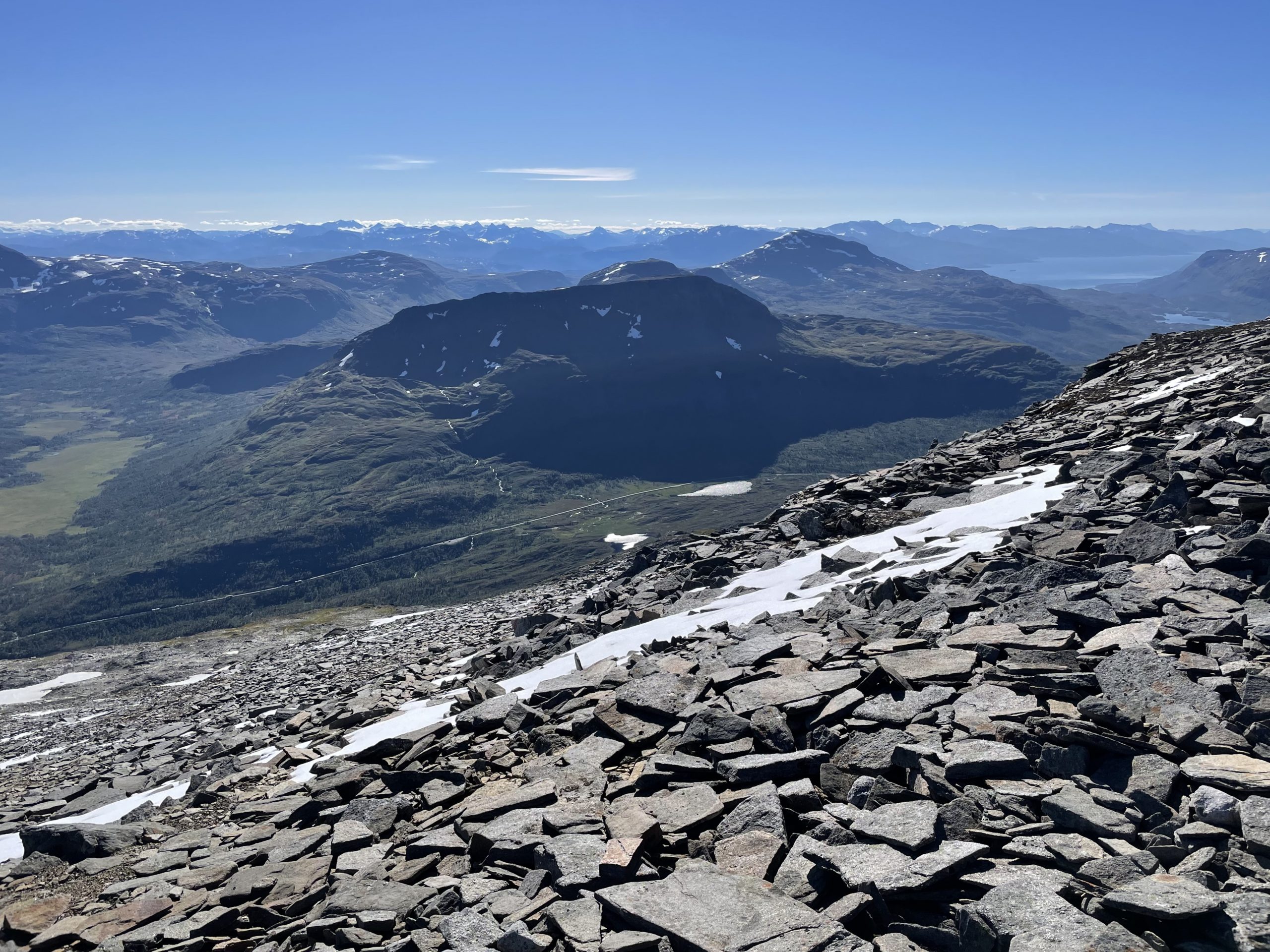
When we got to the summit it was more interesting than it had appeared from our slightly tedious climb. Steep cliffs dropped off to the north and west and separated the main peak from a jagged rocky sub peak just a few unnavigable meters away. Looking over the edge was quite dizzying and the views of peaks all around us left us wanting more mountain days. We signed the book in the summit mailbox and sat down for sandwiches and hot drinks.
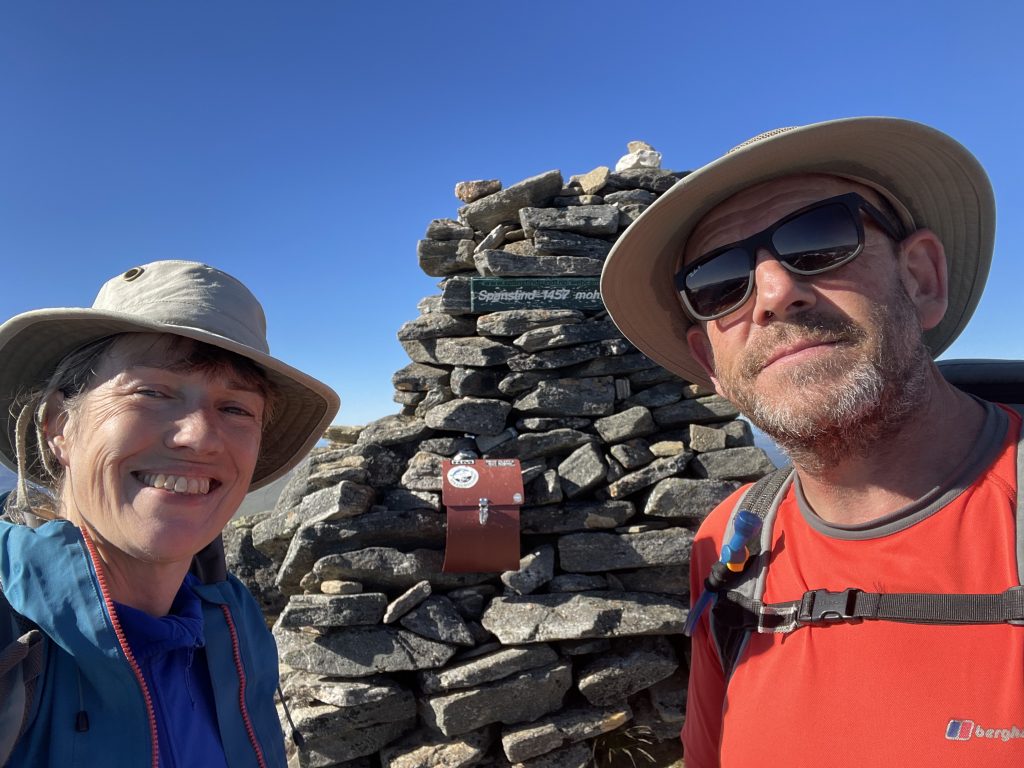
Summit Photo
The descent down the rocky section was a lot faster and easier than the uphill. We speeded down until we reached the swimming pool again where we stopped for some more snacks in a warmer environment. We’d seen a few people climbing up now, obviously most people left their departure until the later in the day, either because they’d been working or because they’d sensibly waited for the edge to be taken off the chilly morning.
The end is in sight
We were glad to be back to the van and get out of our boots into something lighter on our feet. It was our first big mountain walk for some time and we know we’re going to feel it in the next couple of days.